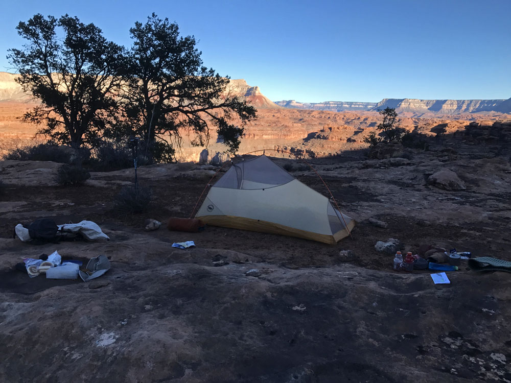
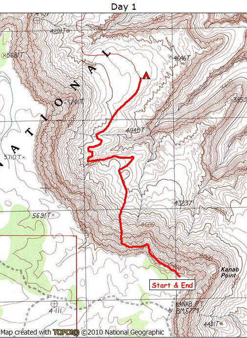
Day 1

March 5, 2018

Kanab Point Trail


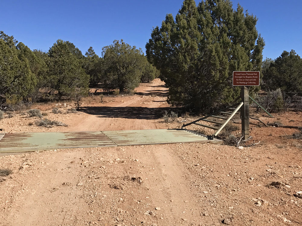
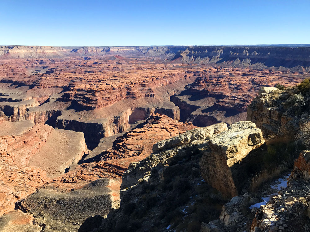
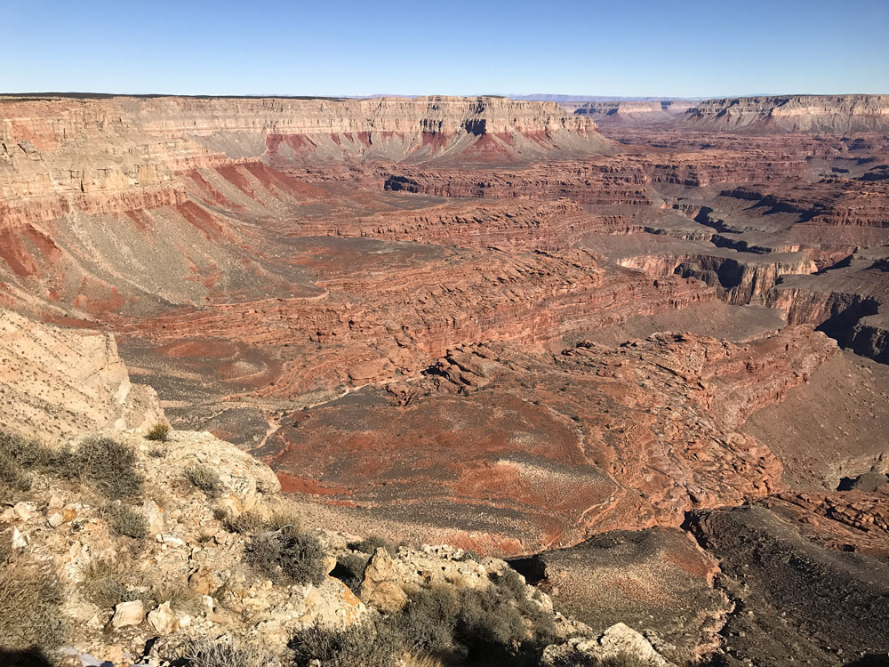
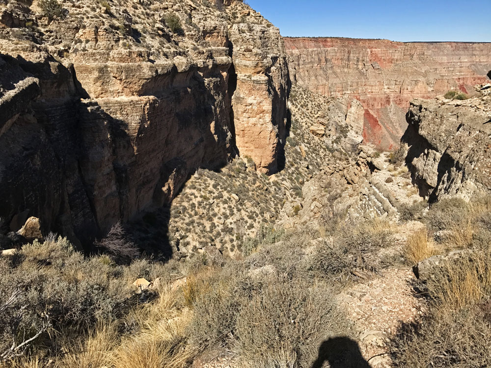
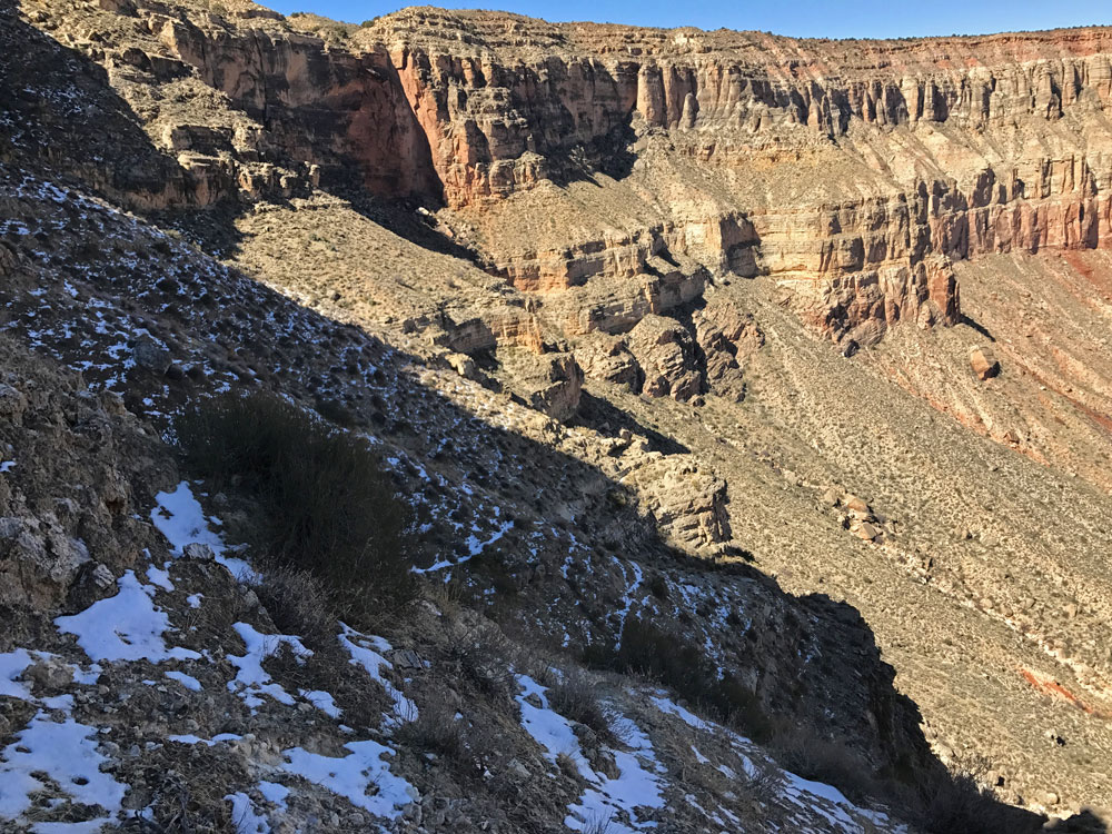
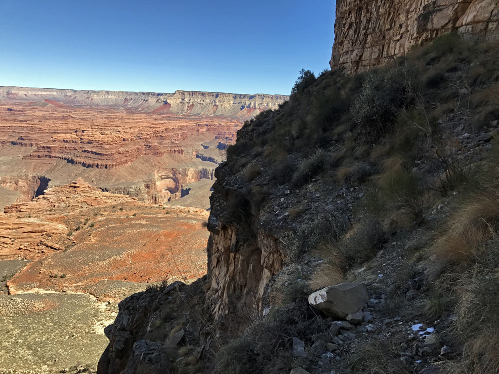
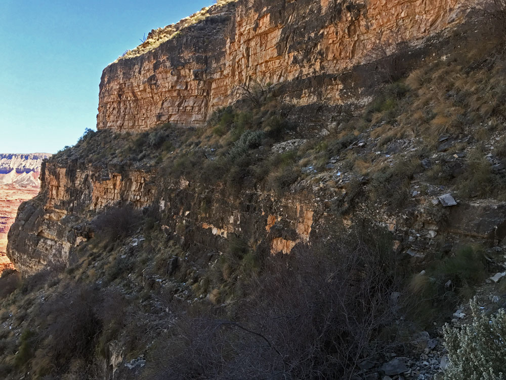
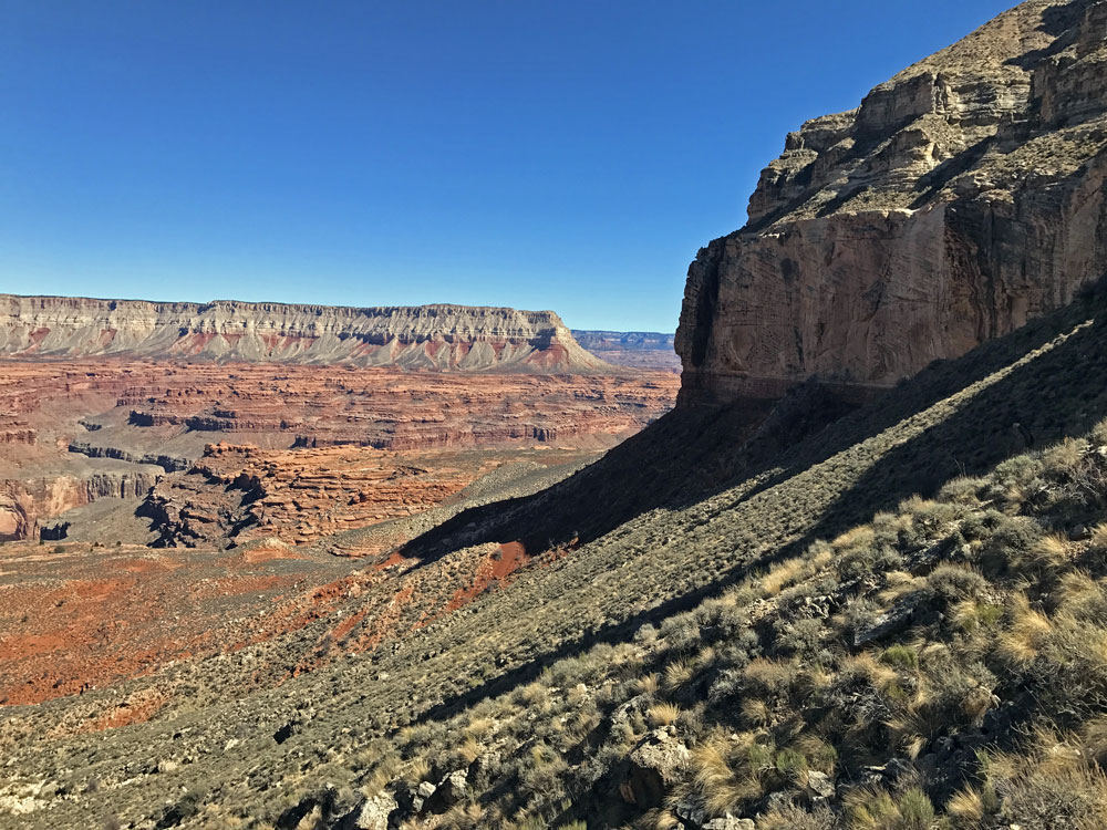
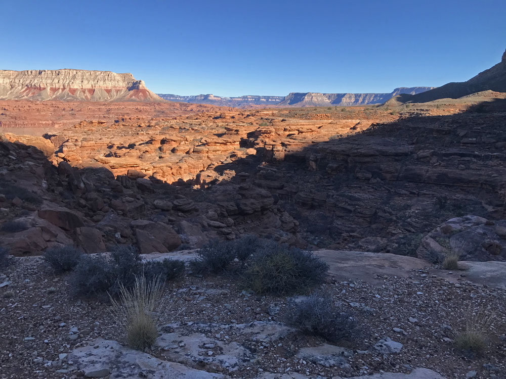
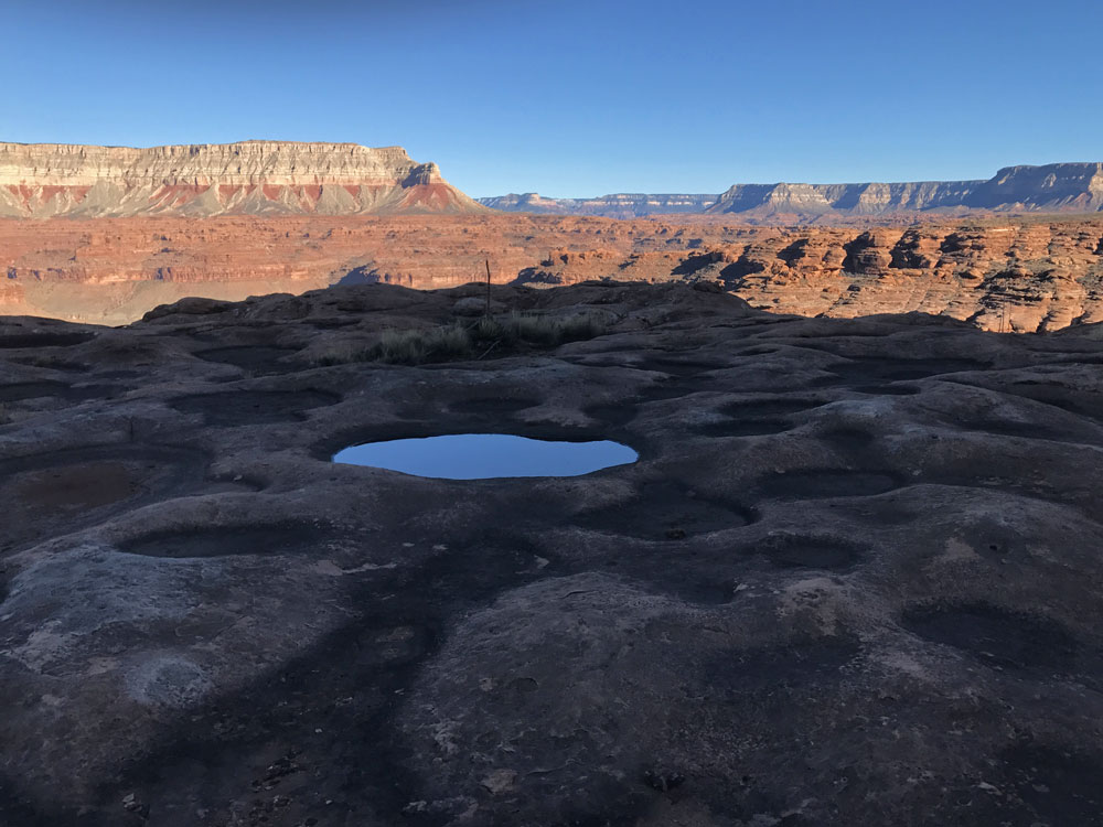
Click on photos to see larger image.

I left Kanab around 7:30 AM.  It is about 15 miles to the start of the Toroweap dirt road.  Because there is a lot of mining and grazing in the area, the road is graded and generally in great shape.  It was very cold -- 17 degrees at 8:00 AM on the Toroweap road.  After something like 40 miles, I turned off onto another, much less traveled road.  Unfortunately, this was the wrong  road and I had to backtrack a bit.  After a few more wrong turns, and several stops to consult maps and GPS, I got on the last 10 miles or so of road heading to Kanab Point.  A high-clearance vehicle is highly recommended for this section, but 4-wheel-drive is unnecessary unless it has recently rained.  I eventually reached Kanab Point around 10:00 AM. 

Kanab Point is on the rim directly above the confluence of Kanab Creek and the Colorado River.

After last-minute futzing with my gear, I used binoculars to look for potholes on the Esplanade below Kanab Point.  The sun was not in the best location to see reflections on the water, but I did see a number of potholes that I thought probably contained water.  But because of this uncertainty, I decided to carry a bit more water than I normally would, just in case I failed to find water and would have to hike back out the next day. 

 
Entering Grand Canyon National Park. View from Kanab Point. View from Kanab Point.


I started hiking at 10:30 AM, later than I had hoped.  Since I had been down this "trail" last year, I wasn't too concerned about route-finding.  The "trail" starts out by going down a shallow draw, then drops down to a valley that parallels the rim (the result of a large hunk of the rim sloughing partway off).  At the end of the valley, the route drops down a very steep slope.  From here the route gets confusing.  You need to find a way down and over to a barren shoulder where George Steck said he found an old pickaxe.  As was the case last year, I never saw it.  From the shoulder the route winds its way along benches, occasionally having to drop steeply to a lower bench.  The last bench leads you to the top of a steep talus slope that leads to the Esplanade.  Total elevation loss is about 1600 feet. 

 
Parallel Valley Near the Top. "Trail" Begins to Drop Steeply. Working My Way Down This Wide Bench.


Route finding was a slight problem.  I was always concerned that I might not be on the correct bench.  There was one place where I had to actually climb down about 10 feet or so.  It was steep and awkward enough that I almost pulled out some cord to lower my pack.  And since I didn't remember this spot from last year, I was nervous that I might not be in the right place.  But eventually I found myself at the top of the steep talus slope.

 
The "Trail" Follows Narrow Benches. Narrow Benches. Finally Got to the Talus Slope.


Although the talus slope doesn't look too steep in the above photo, it is very steep and loose.  I was constantly worried that I would slip and tumble head-over-heals down the slope.  I extended my hiking poles to their maximum length, and with them extended out in front of me, I slowly made my way down the slope.  I inched my way down as I was constantly bent over my poles, and straining to keep from sliding.  It all seemed more difficult than last year, but this was probably due to the fact that I was hiking solo. 

I finally reached the Esplanade after almost 3 hours.  I spotted a couple of potholes and headed directly for them.  I stopped there, collected more water, and ate lunch.  I also dropped off a small cache containing one day's worth of food. 

However, my back was now killing me.  I had planned to continue hiking for a few more hours, but because of my back, I stopped after only an hour on the Esplanade.  I figured that if my back was still bad in the morning, I could end my hike and head back to my car.  I was pleased to find numerous, shallow potholes. 


Esplanade with Fishtail Mesa in Upper Left. Pothole Near Camp. First Night's Camp.


By the time the sun set, it was already very cold.  Because I expected low temperatures at night, I brought my heavier down jacket, down booties, down hood, long underwear top and bottom, gloves, and tent.  Although this added weight, my pack only weighed 26 pounds (without water). 

Once in the tent, I listened to Artemis by Andy Weir.  Andy's previous book was The Martian.  Unfortunately, either a cable or my ear buds were defective and I had to listen through my phone's speaker.  This limited my listening time as the batteries were draining quickly.  Not only do I use my phone as an iPod, it also functions as my camera, GPS, and compass. 


Back to Main Trip Index Back to Trip Index Back to Preface Forward to Day 2