 |
|
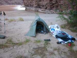
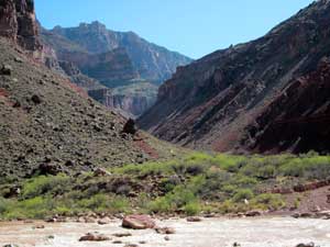
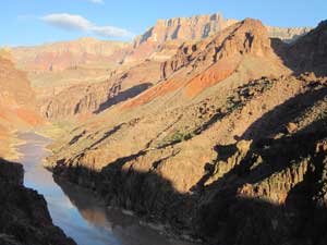
At around 2:30 a raft trip appeared. Yippie! The group consisted of several rafts and kayaks. I threw my hiking sticks and pack into a raft, climbed in, and off we went. The group was from Oregon, and the oarsman was from Salem. He said that two days earlier they had met my friends retrieving a cache at Lava Beach. He also said that because of yesterday's strong up-canyon winds, they decided to take a day off and do some hiking. So that was why I had to wait so long -- others probably did the same thing. I had him drop me off as far down river as he dared (The raft ride is shown as a dashed red line on the map.)
In my excitement to
finally be on my way, I left my hiking poles in the raft.
Damn! This was serious -- my knees were already very sore
from the long hike down the New Hance Trail. And once the
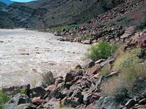
raft had left, there was no way they could come back again and
still be able to run the rapid on the left. They beached
their rafts just above the rapid on river-left and walked down
to scout the rapids. They did have some kayakers who could
easily bring my sticks back to me. But how to communicate
that to them above the roar of the rapids? They spent what
seemed like a very long time scouting the rapids (probably only
20 to 30 minutes). Once they returned to the rafts I was
able to use sign language to communicate to them, and in a few
minutes one of the kayakers paddled over to me with my sticks.
|
 |
 |
 |
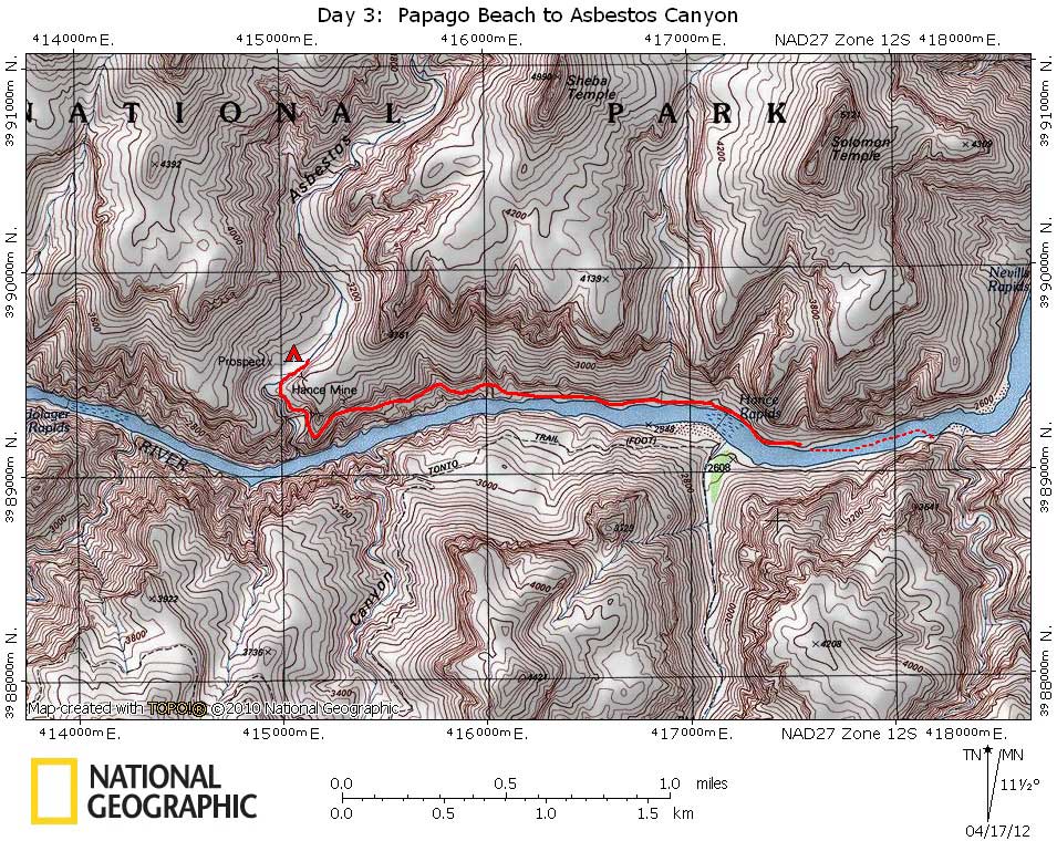
| Camp at Papago Slide Beach | Kayaker Bringing My Hiking Poles | Wade Point at Basalt Intrusion |
|
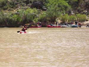
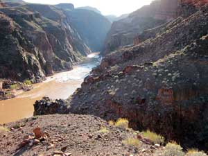
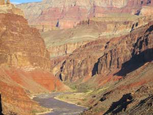
I was now all pumped up and ready to go. I knew there was a large, almost vertical intrusion (dike) that could only be gotten around at or near water level. Although the river flow rate was being maintained to minimize fluctuations, it was still fluctuating by about a foot, and now was the highest of the day. When I got to the dike I was distressed to see that the river came right up the the base of the basalt dike. And the rapids were very close (just out of site in the picture above). I took off my pack and probed the muddy water to see how deep it was. Luckily it was only about a foot deep near the edge. So I put on my pack and carefully waded past this 15 to 20 foot section. Okay, I thought, now I can really make time. But the going along the river was very slow, with piles of large talus blocks to negotiate. In a quarter mile I came to an unexpected spring area and filled my water containers. I now had three quarts of good water. In a couple hundred more yards I started looking for the trail going up the ramp. But now I wasn't sure which level to be on. I thought it should be on the lower level, but I also thought that I had read that the trail starts up the ramp just below the rapids. And the lower ramp didn't start up for close to a half mile beyond the spring. So I thought I should check out the upper ramp before continuing on. I hiked up for a ways with my pack on, then took it off to scout farther up. I couldn't find any trace of a trail, so I went back down, got my pack, and continued along the edge of the river towards the start of the lower ramp. But I soon realized that I didn't have my camera. So I took off my pack and climbed back looking for my camera, figuring my chances were slim of finding it among the acres of talus. But I did! However, it was now a little after 4:00 and I was a little worried that if I ran into any more trouble I might not make it to Asbestos Canyon before dark.
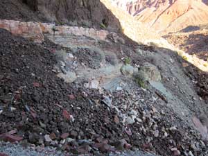
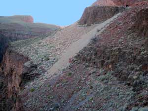
I soon picked up Hance's old
trail and began the slow climb up the ramp towards Asbestos.
The trail is in remarkably good condition, especially since
it has been virtually unused since it was abandoned by Hance
more than a century ago. |
 |
 |
 |
| Mouth of Red Canyon | Talus Blocks Along River | Beginning to Climb Ramp |
|
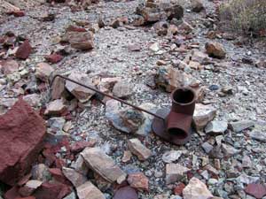
There were a number of small mines along the trail. Most of them were asbestos mines, but I did see some copper ore at one of the mines. They all appeared to be located in the Bass Limestone, a white layer several feet thick. There was a scattering of old iron mining equipment and lots of strands of asbestos laying around. The trail contours below the large mine that is visible from the river (and especially from the Tonto Trail between Red Canyon and Mineral Canyon). The trail eventually rounds the corner into Asbestos Canyon and ends a couple of hundred yards above the huge waterfall that prevents one from walking directly up Asbestos from the river. |
 |
 |
 |
| Old Mining Equipment | Asbestos Strands Everywhere | View Back Towards Red Canyon |
 |
 |
 |
|
View Back to Hance Rapids |
One of Hance's Mines |
Hance's Largest Mine |
 |
 |
 |
|
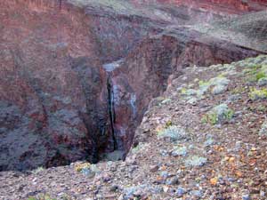
Large Pouroff in Asbestos Canyon |
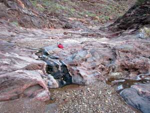
Pools and Seeps in Asbestos Canyon |
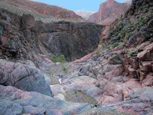
View Down Asbestos from Pouroff |
|
There were some small pools and seeps where the trail reaches the bed of Asbestos, but it looked pretty mineralized, and it tasted slightly salty. It would have to do. This section of Asbestos Canyon is not very pretty, not something I often say about Grand Canyon. There weren't any good areas to camp, but I found a small flat area that was good enough. Although the hike today was only about two miles, and the elevation gain only about 500 feet (not counting all the scrambling I did in search of the trail), I was still pretty tired. |