|
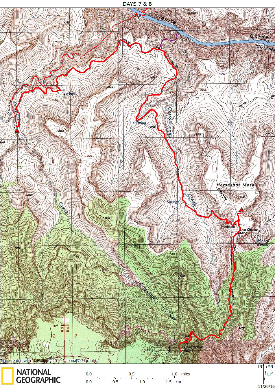
Days 7 & 8 October 21 and 22, 2016 Grapevine to Rim Via Grandview Trail |
 |
|
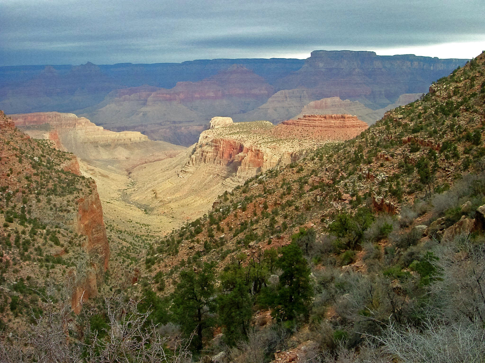
Click on photos to see larger image. Day 7 route stats (to Horseshoe Mesa): Distance: 6.7 miles Elevation Gain: 1350 feet Elevation Loss: 0 feetDay 8 route stats (to Rim): Distance: 2.9 miles Elevation Gain: 2500 feet Elevation Loss: 0 feetOur destination for today was Horseshoe Mesa. We follow the Tonto Trail to Cottonwood Creek, where there should be water. It is about 5 mostly level miles to Cottonwood. From there it is about 1.5 miles and 1300 feet climb to Horseshoe Mesa, which is dry. We could carry water up to the mesa from Cottonwood, or get water by hiking down the other side of the mesa to Page Spring (aka Miners Spring). It is about 550 feet down to the spring. Ben volunteered to hike down to the spring. So he took off ahead of me, figuring he could almost get to the mesa and fetch water by the time I got to the top. I only needed to wait for about 15 minutes before Ben showed up with about 6 quarts of water. There are only designated campsites on the mesa, but we found a nice one. Several groups of hikers showed up after we got there, so it seemed pretty crowded. |