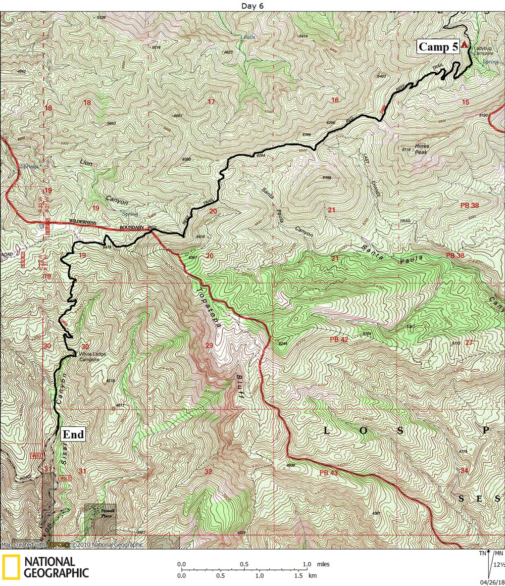
Day 6

April 16, 2018

Lady Bug Camp to Sisar Road Trailhead


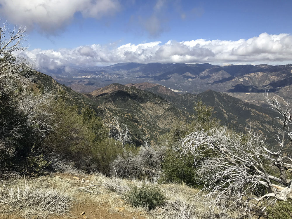
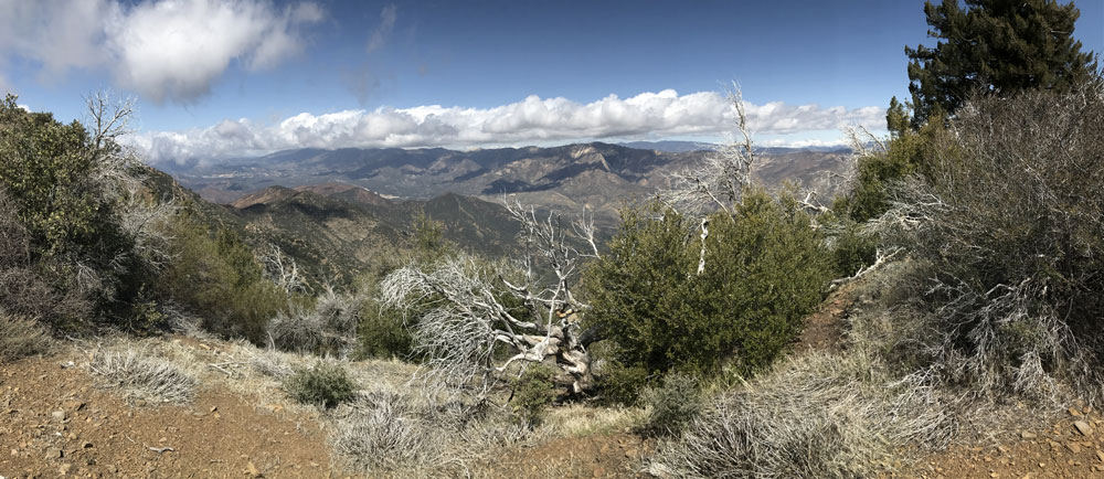
Click on photos to see larger image.

Today's route stats: 

    Distance: 7.5 miles

    Elevation Gain:  1400 feet

    Elevation Loss:  2900 feet

Our original plan was to hike from Lady Bug to Last Chance Camp, which is in the upper reaches of Santa Paula Canyon.  After staying at Last Chance, we were then planning to stay at Bigcone Camp, then hike out the following day.  Since we now had only two days left, we figured it would be too far to go that direction.  But if we stayed on the Red Reef Trail past the turnoff to Last Chance, we could get to White Ledge Camp in one day.  Then our last, and 7th day, would be pretty easy.  So that is what we opted to do.

The hike up to Topatopa ridge from Lady Bug was more of what we did yesterday, with only 1300 feet of elevation to gain.  Once we got to the ridge, wonderful views began to open up in all directions.  The trail passes very close to Hines Peak, a dominant peak on the ridge.  Soon after that, the trail begins following an old and abandoned dirt road.  I saw a trail veering off and into Santa Paula Canyon, but a large branch had been placed at the beginning, so I figured we would come to a newer trail leading to Last Chance.  But we never saw anything else, and we never saw a sign.  Perhaps the log was placed there to warn people of the overgrown condition of the trail. 

View Towards Piedra Blanca. View Towards Lion Camp & Piedra Blanca. Thomas Fire Devastation.


The trail (dirt road) follows the ridge for several miles.  Eventually we came to a locked gate, and shortly after that we came to a side trail heading to the top of Topatopa Bluff.  This is where we abruptly encountered the area burned over by the Thomas fire (the largest fire in modern California history).  It was fully contained only three months earlier. 

We soon exited the Wilderness, and soon after that we turned off onto the trail leading to White Ledge.  The wind had picked up and it was getting very cold.  I put on my down jacket, wind breaker, and gloves.  Because of the devastation caused by the Thomas fire, and the poor weather conditions, someone suggested that perhaps we could hike all the way out without staying at White Ledge.  I figured it would would be way too long -- unless we could get someone to pick us up on Sisar Road, which would save us several miles of road walking at the end.  We had a cell signal, so Paul called his nephew.  He was returning from a car trip and was approaching Santa Barbara.  He said he could be there to pick us up by 5 PM (perhaps earlier). 

After hiking through the Thomas fire devastation for what seemed like a very long time, we finally reached White Ledge Camp.  It had completely burned over.  It is in a canyon bottom amidst a grove of large shade trees.  All the trees were burned.  The place was covered in black ash.  We were very glad to not be camping there. 

We continued on, and after another half mile of hiking, we reached Sisar Road.  Sisar Road was also closed below us, but we knew Josh would have access to a key.  I believe it was about 3:30 when Josh showed up, driving very slowly up the road in my 4Runner.  The fire had burned vegetation that had held rocks on the hillside in place, and now they were all over the road, making driving slow and difficult. 

We drove to Santa Paula, then we all went out for dinner at La Cabaña.  Then back to Ojai for a shower and a soft bed.


Back to Home Page Back to Trip Index Back to Day 5