|
Preface Sespe Wilderness April 11 thru April 16, 2018 |
 |
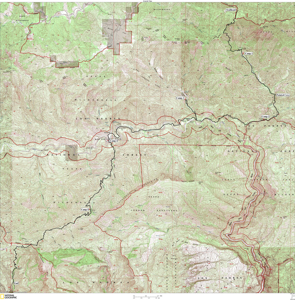
This map (above) shows my overall route. Click on photos to see larger image. The Sespe Wilderness is a unique wilderness area situated north of Los Angeles (NE of Ojai and N of Santa Paula). It is the home of the original California Condor Refuge, which has been closed to the public for many decades (and still is). The area surrounding the Condor Refuge is true wilderness, although it was not always. I grew up in Santa Paula and spent many days hiking and backpacking in the Sespe when I was in high school and college. In addition to Sespe Creek (which is now designated as "Wild and Scenic," Sespe Hot Springs is located in the heart of the wilderness and has attracted visitors for many decades. Once upon a time, one could drive all the way to the hot springs in a passenger car (assuming you didn't mind more than a few dents and scratches). It attracted a wild bunch of "hippies" in the late 60s and early 70s. In 1992, over 119,000 acres were designated as wilderness. It is a part of the 4th largest roadless region left in the Lower 48, and it's the closest to a large metropolitan area. The few roads into the area were abandoned and are now virtually invisible. Sespe Wilderness provides ample evidence of past violent geological upthrusts. The landscape is bleak and jagged. Most of the vegetation is chaparral, but pine and spruce occupy the higher elevations. Fires frequent the area, but because the chaparral has evolved with fire, the vegetation quickly recovers. The riparian areas are lush with Cottonwood, Alder, Sycamore, and Bay Laurel trees. California Live Oak occupy benches in the canyon bottoms. Bear, bobcat, mountain lion, deer and coyotes frequent the area (plus numerous lizards and snakes and birds). Although we didn't see any bears or mountain lions, we did see their tracks. At my 50th high school reunion last August, Rich Magill, Paul Carlson and I discussed a possible trip into our old stomping grounds. We decided on a week-long trip, starting at one of the high elevation trailheads and ending at one of the trailheads between Ojai and Santa Paula. We settled on a trip starting at a little-known trailhead east of Mutau Flats, hiking down the abandoned trail to McDonald Cabin and Painted Cave (AKA Indian Cave), on to the hot springs, then over the Topatopa mountains and down to the upper Ojai valley. We settled on a date in April. I also invited one of my favorite Grand Canyon hiking companions, Ben Mahlab, from New Hampshire. I drove to Ojai from Arroyo Seco, stopping for one day of hiking/exploring from the north rim of Grand Canyon. I picked up Ben at LAX, then drove to Ojai where we spent the night at Richie's.
|
|
|
| Back to Home Page | Back to Trip Index | Forward to Day 1 |