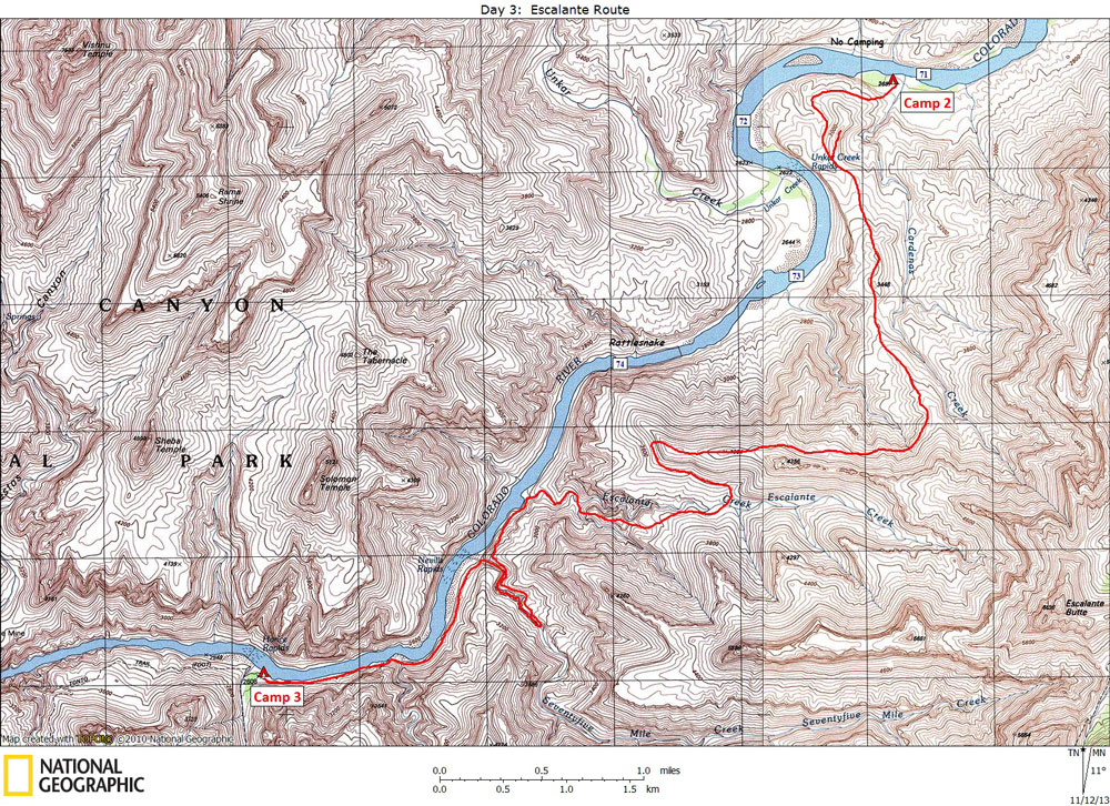
Day 3

October 14, 2013

Escalante Route:  Cardenas Beach to Red Canyon


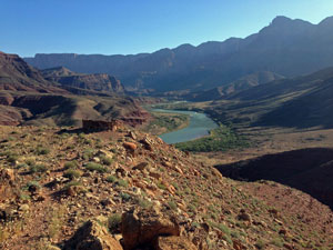
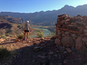
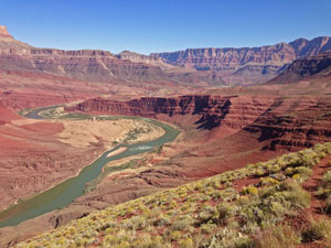
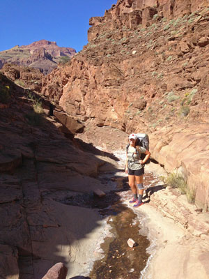
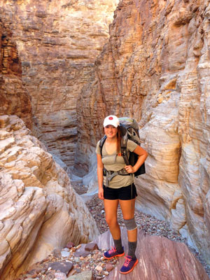
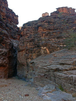
Click on photos to see larger image.

Today's route stats: 

    Distance:  9.0 miles

    Elevation Gain:  1700 feet

    Elevation Loss:  1700 feet

I was expecting today to be long and tiring.  We would technically be off-trail, but enough people have been hiking this route in recent years that a pretty good trail has developed.  There is still a bit of route-finding required in a few places.  And we would need to negotiate the infamous Papago "wall" and "slide".

In a Park Service handout, an overview of the route is described as follows:

Among the commonly hiked sections below the South Rim, the Escalante Route has a reputation for requiring a bit extra from Grand Canyon hikers. Several passages encountered along the way require exposed hand and toe climbing. A feel for the route ahead will save time at the difficult spots. The Colorado River is usually the only reliable source of water, so fool-proof methods of turbid water purification are a real necessity. On the other hand, you are presented with a delightful variety of canyon environments, ranging from the wide open spaces of Furnace Flats, to the slot-like confines of lower Seventyfive Mile Creek. Hance Rapids at the mouth of Red Canyon represents the premier stretch of whitewater in the upper reaches of the Grand Canyon. Changing geology, as the sedimentary Supergroup gives way to the ancient Vishnu Complex, combine with remarkable views from a variety of elevations to produce a Grand Canyon experience of the first order.


View of "fort" built by the ancients. Brianna and "fort", Looking Up-Canyon. Looking Back.  Unkar Delta Center Left.

We got off to a leisurely start, although Brianna thought an 8:00 start was early.  A well-trodden trail heads up from Cardenas to the hilltop with the ruin.  It is hard to know what this structure was used for.  Probably some sort of lookout.  It certainly has expansive views both up and down river. 

Brianna began having serious pain in her knee.  I had not brought an ace bandage or a knee brace.  As we were brain storming a way to wrap her knee with what we had, Brianna came up with the idea of cutting off the top of one of her hiking socks, and pulling it up around her knee like a knee brace.  It worked really well.  She is wearing it in the photos below.

Escalante Creek. 75-Mile Canyon. The Papago Wall.

The Escalante Route goes up and over a high ridge, then drops down into the Escalante drainage.  The main drainage has an impassible pouroff which is bypassed on the left.  Eventually you rejoin the Escalante and continue down to the River. 

Once at the River we headed down-canyon, following a rising ramp that would take us into the 75-Mile drainage, but a couple of hundred feet above the canyon bottom.  Once we rounded the corner into 75-Mile, we continued another half mile or so until we could get down into the bottom of 75-Mile Canyon.  This is a beautiful and narrow canyon cut into sparkling quartzite.  It is an easy and fun walk down through the narrows to the River.

At this point we were both feeling pretty good and figured we would easily make it to camp before dark.  We picked up a constructed trail that leaves the mouth of 75-Mile Canyon and heads up, through the sand dunes, then continues down-canyon, staying about 100 - 200 feet above the River.  This is a very rough section with lots of boulders to deal with.  I think it would have been much better to stay low on the beach for about half the distance to Papago, then climb up to the "trail".  We were tired and frustrated by the time we got to Papago.

The Papago Wall, located at the mouth of Papago Canyon, rises about 35 feet.  But the lower 15 feet is easily climbed to a flat bench where the real climbing begins.  Although there are bomber hand and foot holds, and the rock is solid, the exposure is serious.  Brianna could not believe we had to climb it.  I climbed it first, with my pack, then climbed back down to get Brianna.  She climbed without her pack as I spotted her along the way.  She was terrified, but made it to the top in just a few minutes.  I then climbed back down to get her pack. 

At the top of the wall a faint trail continues higher until eventually it levels out, turns left and ends up at the top of a very steep chute, referred to as the Papago Slide.  Brianna was pretty spooked here too, at least in the upper section.  By the time we got back down to river level, the sun was about to set.  We still had a little over half a mile to go.  By the time we got to the beach at Hance Rapids, it was almost completely dark.  We had to pitch the tent and make dinner in the dark.  Although we were both tired, we stayed up and talked a little later than usual. 


Back to Main Trip Index Back to Trip Index Back to Day 2 Forward to Day 4