|
Preface Esplanade: Chamberlain to Scotty's March 17 thru March 21, 2019 |
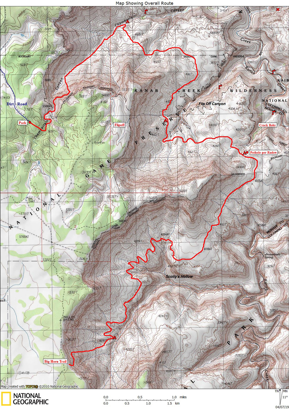 |
This map (above) shows our overall route. Click on photos to see larger image. I had originally planned to do two Grand Canyon trips this spring: one with my old high school friend, Rich Magill, and the other with my frequent hiking companion, Ben Mahlab. Numerous issues resulted in my trip with Ben being cancelled, and Rich got a detached retina about a month before our trip, so he had to cancel. I had previously invited Jay Lawrence (who I only knew thru the Yahoo Grand Canyon Group) on the trip with Rich. In the meantime, I was invited along on a trip with some folks who I only knew thru the internet. They were planning an Esplanade trip, starting at either Chamberlain, Flipoff, or Hack, and ending at either the Scotty's route or the Kanab Point Trail. So I invited Jay to join us on that trip. But because of the horrible weather and snow conditions on the road to the trailheads, we had to wait for conditions to improve. Jay was planning to drive from Minnesota, but by the time we decided to go, an epic snow storm prevented Jay from making the drive safely. And the airports were closed too, so he had to cancel. I have never had this much trouble putting a trip together before. So I ended up doing the trip with three others who I hadn't met before: Jorge Fulco, Ben Everitt, and Kim Riding. I had been emailing Jorge for a while before this trip, discussing routes and rock art. He lives in Santa Barbara. Kim and Ben are from Saint George. We eventually agreed on a 6-day trip, starting at Chamberlain and exiting via the Scotty's Route (AKA Big Horn Trail). I was not thrilled about doing the Chamberlain route because the steep downhill on loose talus really aggravates by back. But it was a new route for me, and the others agreed that we would stop on the Esplanade and make camp at the first nice spot we came to. So I was looking forward to doing this new route. I left Arroyo Seco (NM) the morning of March 15. After driving for about 40 minutes, the road I was planning to take was closed because of heavy snow (this road climbs to over 10,000 feet). So I had to detour farther south, adding about an hour to an otherwise long drive. I spent the night in Page, Arizona. The next day I drove to Kanab, did a bit more food shopping, then drove to Pipe Spring National Monument where I met the others around 1:30. From there we drove to the "trailhead" above Chamberlain Canyon. The roads were in surprisingly good condition. Kim cooked a great dinner for us at the trailhead. |
|
|
| Back to Main Trip Index | Back to Trip Index | Forward to Day 1 |