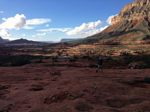
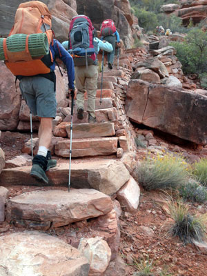
Day 3

October 29, 2013

Ranger and Jumpup-Nail Trails to Indian Hollow


Click on photos to see larger image.

Today's route stats: 

    Distance:  13.5 miles

    Elevation Gain:  1000 feet

    Elevation Loss:  1200 feet

Thankfully it was mostly clear when we awoke in the morning. 

We were now about 5 miles behind our original schedule.  We really wanted to get to Indian Hollow, but the distance we needed to cover seemed daunting.   We intended to spend two nights in Indian Hollow and climb Fishtail Mesa on our layover day.  We also needed to pick up our cache, which was closer, but still about 9.5 miles away.  We could decide where to stop later, depending on how everyone was feeling.

Sunrise on the Esplanade. Approaching Jumpup  on the Ranger Trail The Gooseneck from the Ranger Trail.

It was cool, crisp, clear and beautiful as we began hiking around 8:00.  It was perfect hiking weather and everyone was blown away by the beauty that engulfed us.  The expansive views were glorious.

Fetching Pothole Water. Jumpup-Nail Trail. Sowats Canyon.

We made pretty good time on the Ranger Trail, arriving at Jumpup Canyon, about 1/2 mile above Lower Jumpup Spring, around 10:00.  From here we joined the Jumpup-Nail Trail and continued along the Esplanade below the Gooseneck.  The trail is very easy to follow and offers spectacular views.  We reached Sowats Canyon around 11:30.  The trail drops steeply into Sowats Canyon.  Near the bottom are some wonderfully crafted stairs.  They actually seemed out of place -- much better constructed than the rest of the trail.  Once reaching the bottom of Sowats, the trail heads up another series of stairs on the other side of the canyon.  These trails were originally constructed decades ago by cowboys running cattle in the area.  But these stairs looked like they were constructed by a well-trained crew -- perhaps by a Sierra Club service trip (I have seen then in the area before). 

Stairs Dropping into Sowats Canyon. Resting in Sowats Canyon. Stairs Climbing Out of Sowats Canyon.

We reached our cache at the head of Kwagunt Hollow around 1:00.  I had hiked down from the beginning of the Jumpup-Nail Trail 4 days ago to place one 5-gal and one 3-gal plastic bucket, along with two liters of fuel.  I placed it in the rocks just south of the Kwagunt drainage. 

We all had lunch and then spent quite a while sorting through the cache and distributing it between us.  We cut up the plastic buckets and distributed those pieces as well.  Most of us collected more water in Kwagunt, which had a nice flow of water. 

Entering Indian Hollow Spring Canyon. Ruin in Indian Hollow Spring Canyon. Campsite in Indian Hollow.

We finally left Kwagunt and our cache site around 2:15.  We continued on the trail, which remains easy to follow for the next mile, but then it begins to fade.  This section of the trail has been abandoned 
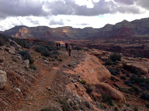
and is not on any maps that I know of.  Once we lost the trail for good we decided to just follow slickrock benches.  Our goal was the drainage that comes down from Indian Hollow Spring and ends in Indian Hollow.  We later realized that the trail stayed higher, up in the blackbrush above the slickrock.
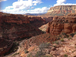
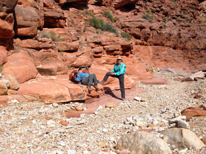
We soon reached the Indian Hollow Spring drainage and found a way down without much trouble.  This unnamed drainage is much prettier than I expected.  After only a half hour or so we came to a large 
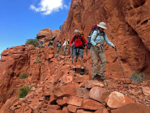
pouroff.  It wasn't obvious whether the best way to bypass it would be on the right or left.  There were some large cairns on creek-left so I headed off that way while the others continued to look around.  My way was very brushy, while the other side looked easy.  I noticed a possible way down on the other side of the drainage from me, and I told the others to give it a try.  But when they finally got there, they said that they were on a pretty good trail and would continue on, hoping to find a way down at the nose.  I continued on the creek left and found a pretty easy way down at the nose.  The other side was just as easy.  So for those who plan to hike down this drainage, I highly recommend creek-right all the way to Indian Hollow.  Creek-left is doable but more difficult.  And if you're coming up from Indian Hollow, be sure to climb the nose and follow the bench on creek-right until past the pouroff.
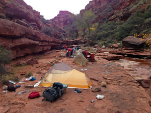
Once in Indian Hollow, we hiked down canyon for only about 1/4 mile and stopped at a nice slickrock campsite.  Clouds were starting to build again and we all set up our tents.


Back to Main Trip Index Back to Trip Index Back to Day 2 Forward to Day 4