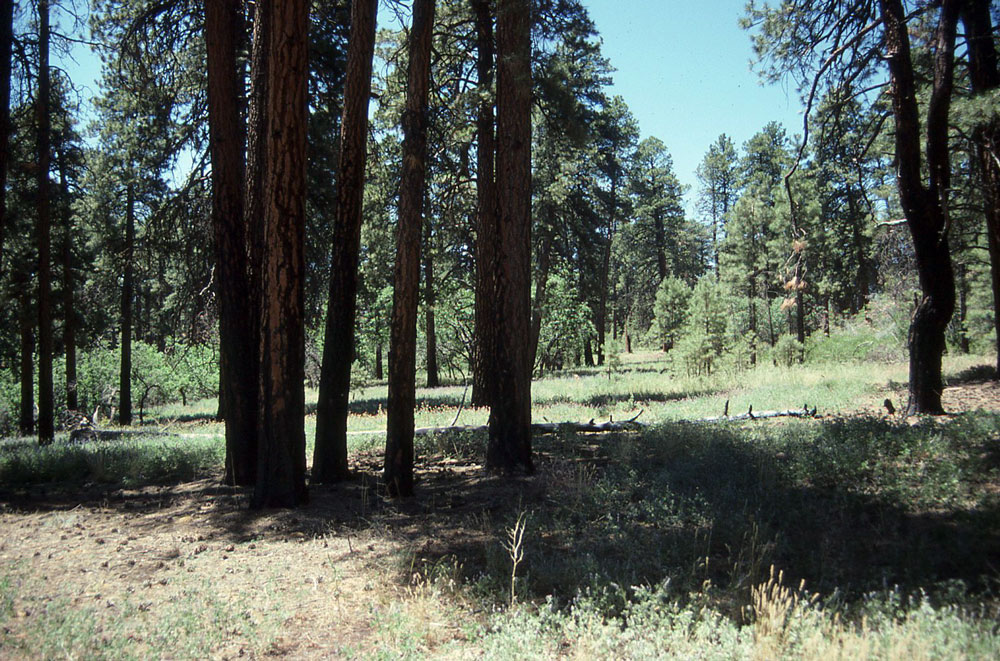
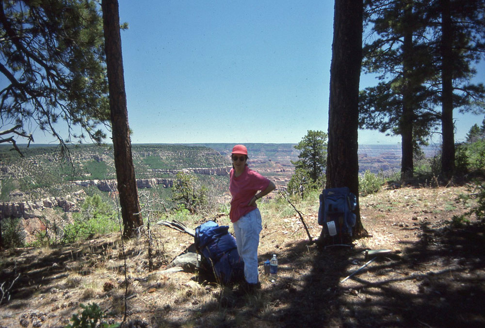
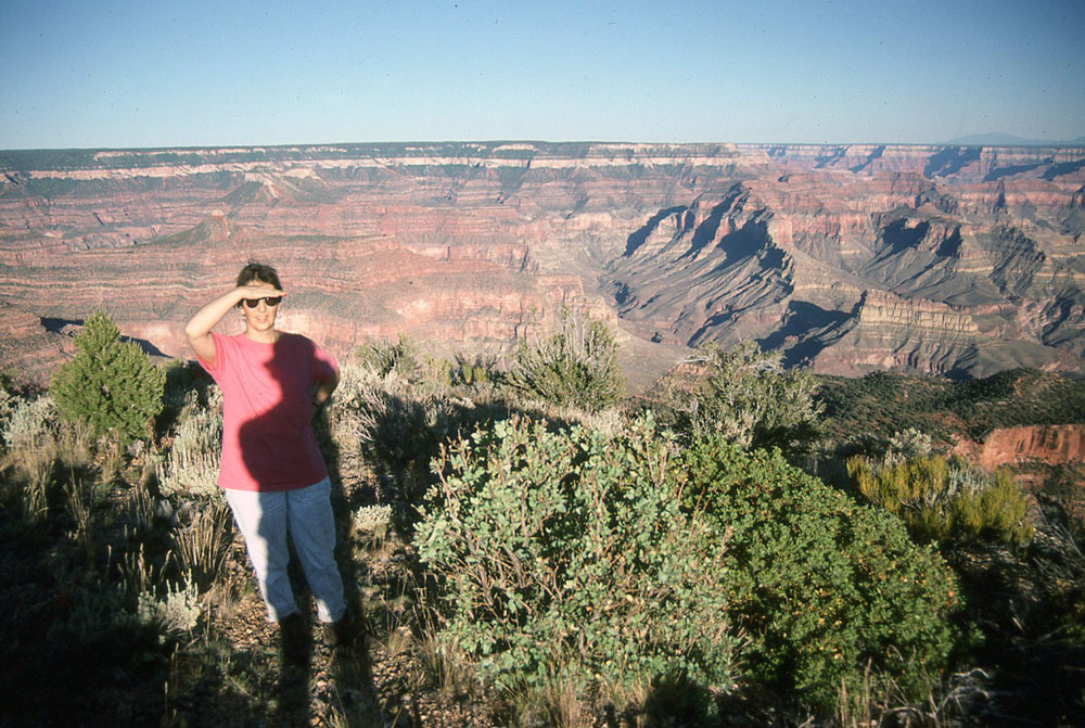
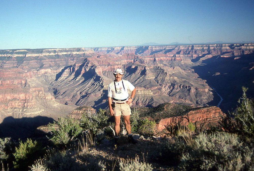
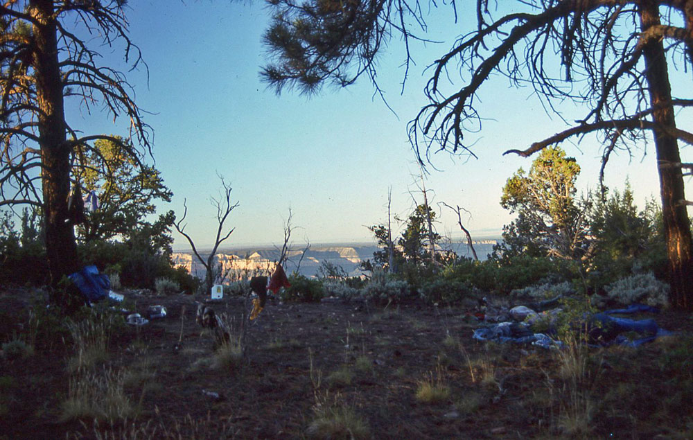
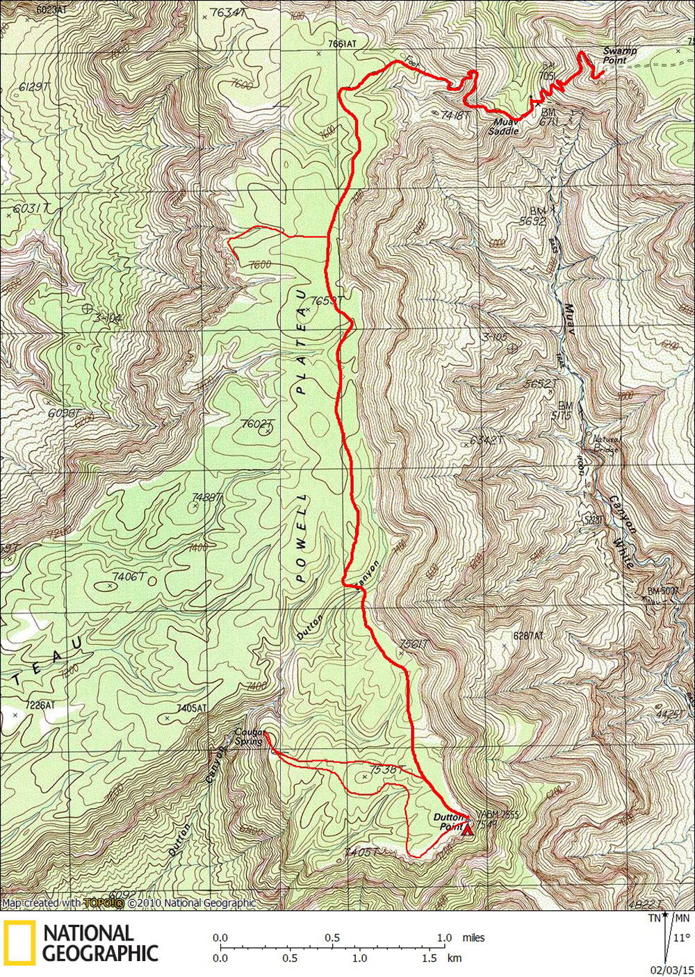
Day 1

June, 1991

Swamp Point to Dutton Point


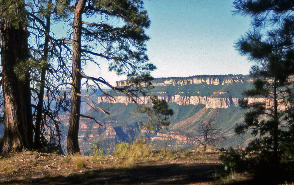
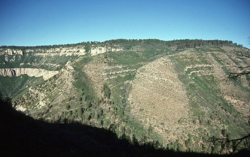
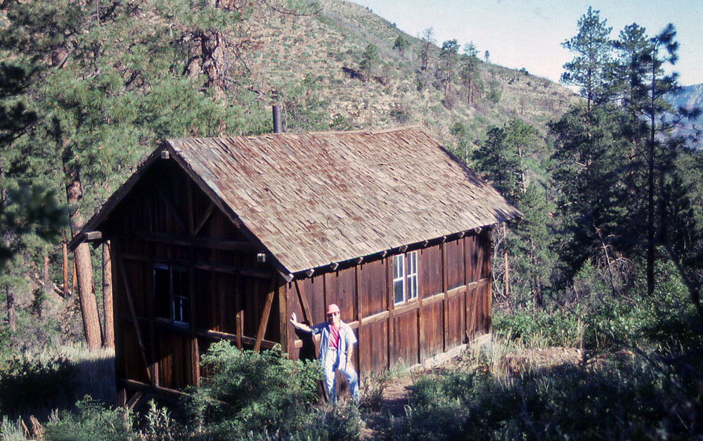
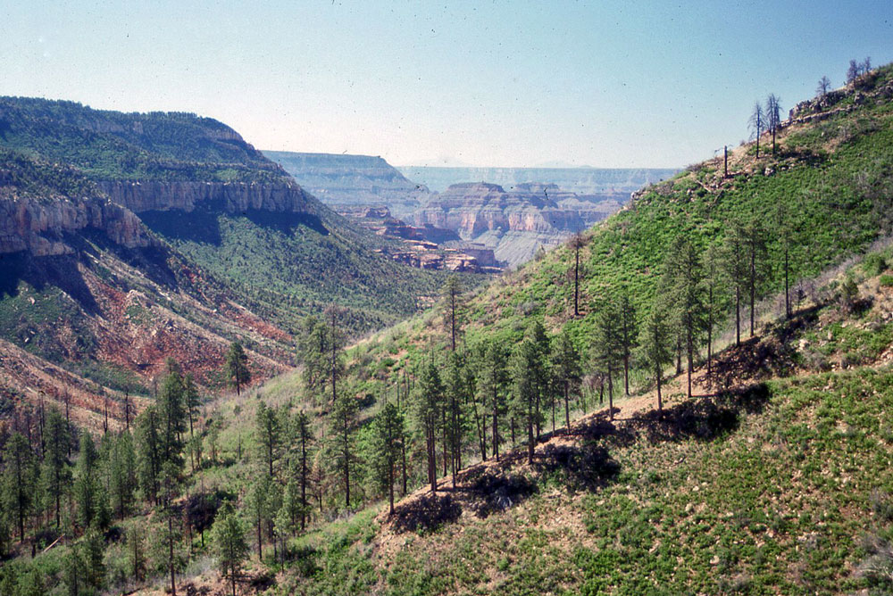
Click on photos to see larger image.

Today's route stats: 

    Distance: 5.7 miles

    Elevation Gain:  800 feet

    Elevation Loss:  800 feet

The biggest problem with this backpacking trip is the lack of water on Powell Plateau.  Since we wanted to spent two nights at Dutton Point, we needed to haul a lot of water. 

We started out with a couple of quarts each, plus two 2-1/2 gallon jugs of water.  So we probably had about 6 gallons total.  I started out hiking with my pack and one jug in each had.  I made it to Muav Saddle, but then decided that it would be easier shuttle the water separately.  So even though we only had 5.7 miles to hike, it took nearly all day.

We took a long break on Muav Saddle and checked out Teddy's Cabin.


View of Powell Plateau From Swamp Point.


View of Powell Plateau From Swamp Point.


Teddy's Cabin.

The following quote is from John Azar, excerpted from the January 1995 issue of The Ol'Pioneer:

My favorite cabin within the Grand Canyon is located on Muav Saddle. It is one of three identical "snowshoe" exterior-framed patrol cabins built under the direction of the Park Service in 1925 in conjunction with improvements to the trail from Swamp Point to Powell Plateau. The Muav Saddle Cabin and the Kanabowitts Cabin are the only ones remaining today. The Muav Saddle Cabin, known in Mormon country as "Teddy's Cabin," was almost destroyed by the summer fire of 1988 that burned around 3,000 acres on and below Powell Plateau. The flames reached within 100 feet of the cabin before being brought under control.

It had been three years since the fire, and the destruction was still obvious.  The slope surrounding the trail leading up to the plateau had been completely burned.  Once we got on top of the plateau, I hiked back down to the saddle to get our water. 

Once on top, the trail begins to fade away.  However there were numerous metal "blazes" nailed to the trees directing our way.  The blazes continued for a couple of miles and then they disappeared too.  We continued hiking using only map and compass.  Occasionally we got close enough to the rim to get wonderful views to the east.

View Down Muav Canyon (White Creek).


Powell Plateau.


Kathey on Powell Plateau.


Once we got to Dutton Canyon, the hiking got harder.  Dutton Canyon is deeper than we expected, and also thick with vegetation.  By the way, Dutton Canyon becomes Walthenberg Canyon below the Esplanade.  Then, near Dutton Point, the conditions improved again.  Although there were many great camping spots on the plateau, they were scarce at Dutton Point.  But we did find a spot that was decent, and close enough to the rim to get some good views.  Because of all the water shuttling, we didn't get to Dutton Point until late afternoon.  And one of the 2-1/2 gallon jugs was left about a mile from Dutton Point, to be picked up tomorrow.

Kathey.


Bob.


Our Camp.


Back to Main Trip Index Back to Trip Index Back to Preface Forward to Day 2