Day 1

October 19, 2022

Hike to Table Rock in Snake Gulch via ToothPick Canyon


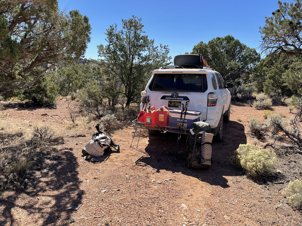
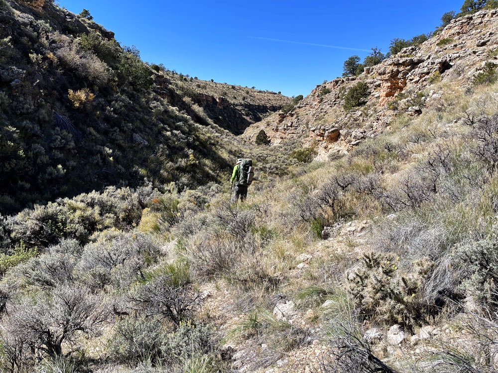
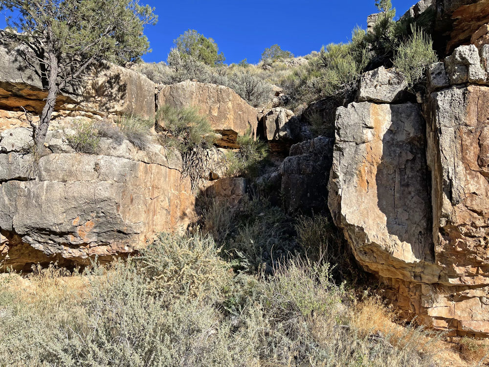
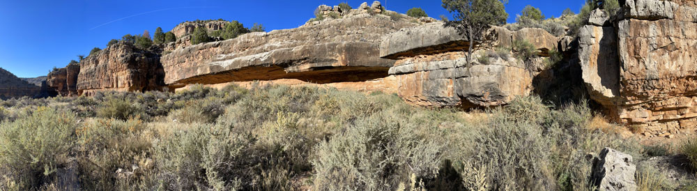
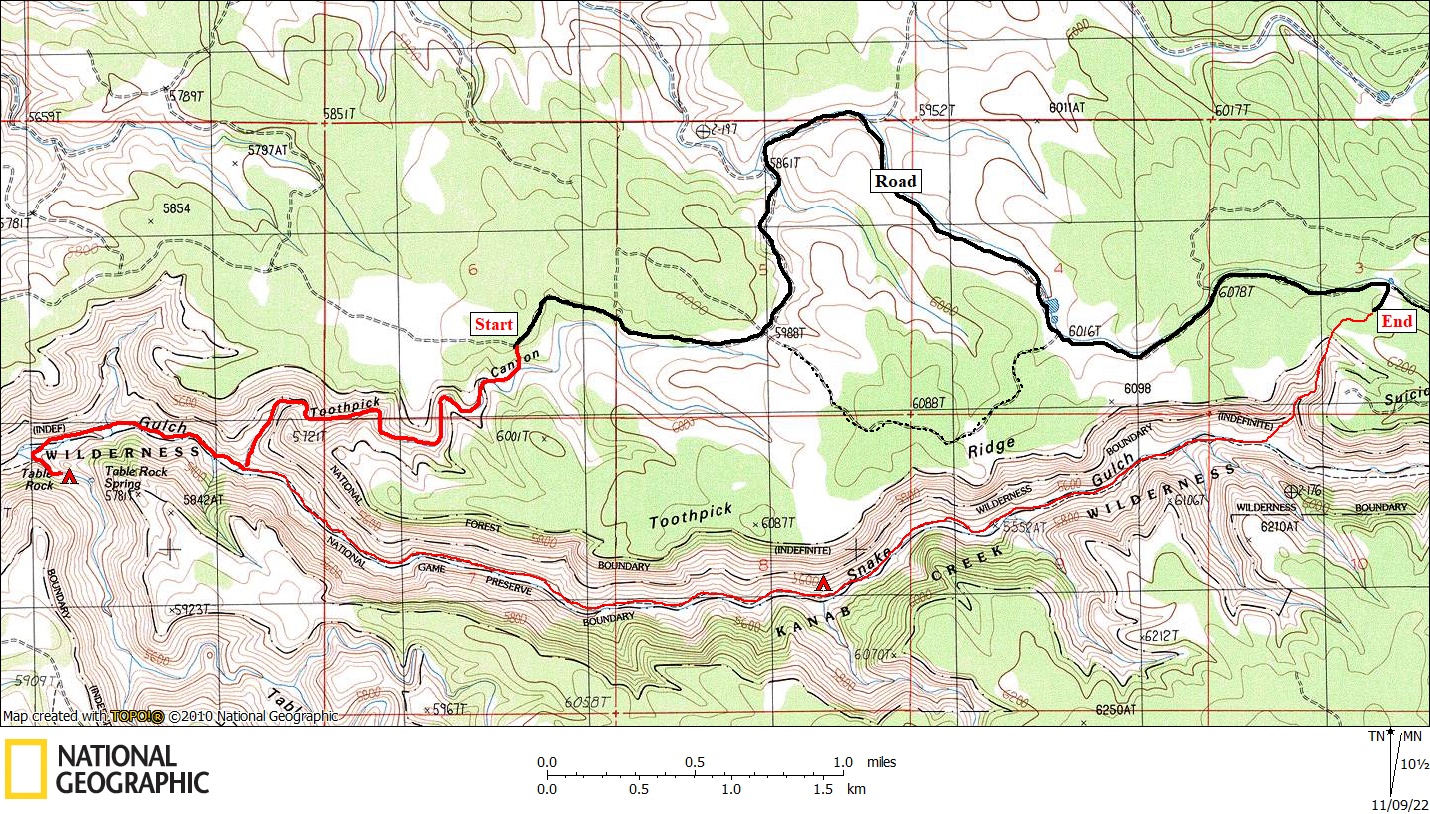
We left Page around 8:30 AM and drove to Jacob Lake in a little under two hours.  We stopped at the cafe in Jacob Lake for an early lunch.  We then drove to the end point of our hike and dropped of the bike as well and some water.   The roads out there on the north side of Snake Gulch were completely unmarked and in worse condition than expected.  So we stopped and checked the GPS several times.  At our end point, we looked down into the un-named canyon that would be our exit.  It didn't look very steep.  We continued on to our start point at Toothpick Canyon.  Toothpick didn't look excessively steep either, although we couldn't see the entire route.  I read a trip report before this trip which described a trip into Snake Gulch via a route a bit west of Toothpick.  They ended up turning around because of impassible cliffs at the very bottom.  They were angry that the topo map didn't show these cliffs, nor did Google Earth.  They should have known that 40-foot contours can hide a substantial cliff, and that Google Earth should never be relied on for showing how sloped the terrain actually is.   But since they didn't go directly down the Toothpick drainage, I figured we would have better luck.


We Started Hiking from Here.


Starting Down Toothpick Canyon.


Break in Cliff Band.


The route began easily enough, but we soon got into thick brush.  It wasn't steep, but the brush made for slow and unpleasant hiking.  At the bottom, less than a hundred feet above the floor of Snake Gulch, we came to the cliff band that we had heard about.  And it was way too steep to continue straight down the drainage.  With a bit of scouting, we found a break in the cliff only a hundred yards or so up-canyon from the mouth of Toothpick.  It was an easy downclimb, but we did pass packs.  The panorama below shows a stretch of the cliff band, with the break on the right side.


Once we reached the canyon bottom, we picked up the trail and continued down canyon for about a mile to Table Rock.  I was surprised to not find any good camping spots.  We ended up camping in the drainage a short distance up the side canyon to Table Rock Spring.  Total distance for the day was only about 2.6 miles.


Table Rock Spring.


Table Rock Canyon Near the Spring.


Table Rock Spring had been "improved" by ranchers.  The water in the catchment basin was clear and cold.  I was relieved since the last report I had told of a dead bat in the pool. 

I brought along audio books on my iPhone, as I usually do.  I listen to them after I settle in for the long nights in the fall.  This time I began listening to The Vital Question by Nick Lane.  I decided it was not a great audio book -- too much technical detail to keep track of.  So I switched to The Thursday Murder Club by Richard Osman.  So far I'm loving it.


Back to Main Trip Index Back to Trip Index Back to Preface Forward to Day 2