|
Preface Snake Gulch via Toothpick Canyon Kanab Creek Wilderness October 19 thru October 21, 2022 |
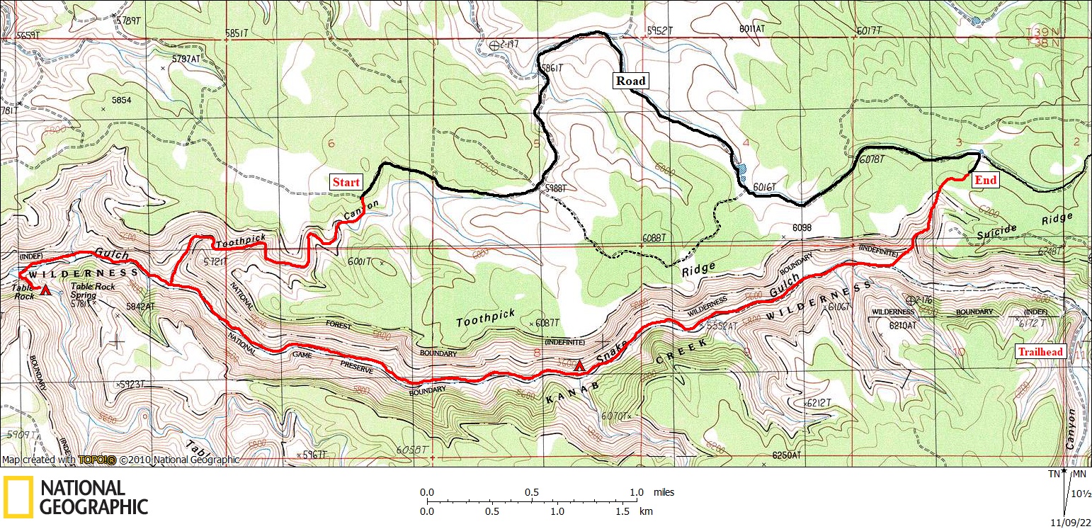 |
This map (above) shows our overall route. Click on photos to see larger image. I had previously visited Snake Gulch back in April of 2014 as part of a larger hike from Sowats Trailhead. Our last campsite on that trip was at the mouth of Pigeon Canyon. We woke up the last day covered with snow. And it was still snowing as we hiked to the usual trailhead about 8.5 miles away. We were so cold and miserable that all we wanted to do was get back to our cars. So we missed seeing most of the rock art. Since then I have wanted to return. I remembered the canyon as being pretty boring (except for the rock art). So I didn't want to do an in-and-out trip covering the same terrain twice. By studying the USGS topo maps, Google Earth, and others' trip reports, I came up with a plan: Hike in via Toothpick Canyon, and hike out via an un-named canyon about one mile from the usual trailhead. I asked around for any info on hiking Toothpick Canyon, but got nothing. This trip would require a shuttle. Rich Magill joined me on this hike, as well as some car camping and exploring some of the remote backcountry roads. Rich had never been to Snake Gulch. Because we wanted to explore 4x4 roads, I didn't want to be encumbered by carrying my motorcycle using my trailer hitch carrier (as I have done several times before). I had recently purchased an electric bicycle, which would do nicely for this short (4.5 mile) shuttle. And the bike can fold up and be carried inside my 4Runner. I drove to Page on October 18, and picked up Rich from the Page airport that afternoon (he flew in from Santa Barbara). We spent the night at a motel in Page. |
|
|
| Back to Main Trip Index | Back to Trip Index | Forward to Day 1 |