|
Solo Exploration: Indian Hollow, Kwagunt, Sowats and Jumpup Canyons
NOTE: Click on Hypertext to view photos.
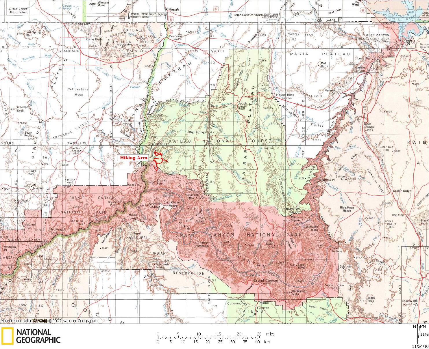
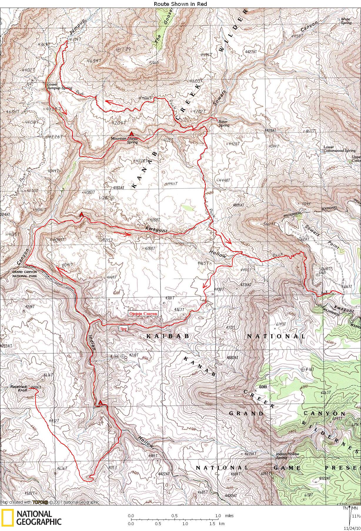
Two maps show the route: Preface. I completed a Steck loop (Deer Creek / Kanab Creek) this October with a group of 9 friends. I had done the loop once before, and parts of it many times. After returning to Boulder, I got an itch to return to the area and do a backpack around Fishtail Mesa on the Esplanade. The original plan was to do the hike solo, starting at the Bill Hall Trailhead (near Indian Hollow campground). I was going to spend the first night at Hualapai Spring in upper Fishtail canyon, continue around and exit via the Jumpup-Nail trail (AKA Sowats Point trail), then hike the 5-6 miles back to my car. Because of the very dry conditions, I thought it best to do the loop in the opposite direction (CCW). I figured that if conditions turned out to be too dry, I could always abort the hike around Fishtail Mesa and just explore the Sowats area instead. So on Monday morning, November 9, I drove from Kanab to Indian Hollow where I placed a small food and water cache, in case I actually made it around Fishtail. I then drove to the Jumpup-Nail trailhead near Sowats Point.
Although I have this like listed under "Grand Canyon", it is mostly outside Grand Canyon National Park. Indian Hollow is the boundary; north of Indian Hollow is Kanab Creek Wilderness. The only part of my hike actually in the park was the day hike to Racetrack Knoll.
Because of the very long nights at this time of year, I brought my iPod with two audio books that I had previously downloaded: American on Purpose by Craig Ferguson and The Greatest Show on Earth by Richard Dawkins.
November 9, 2009. The Jumpup-Nail trail starts about 3/4 mile south of Sowats Point. The trail is in very good condition all the way down to the Esplanade. It starts out heading west down a
shallow drainage
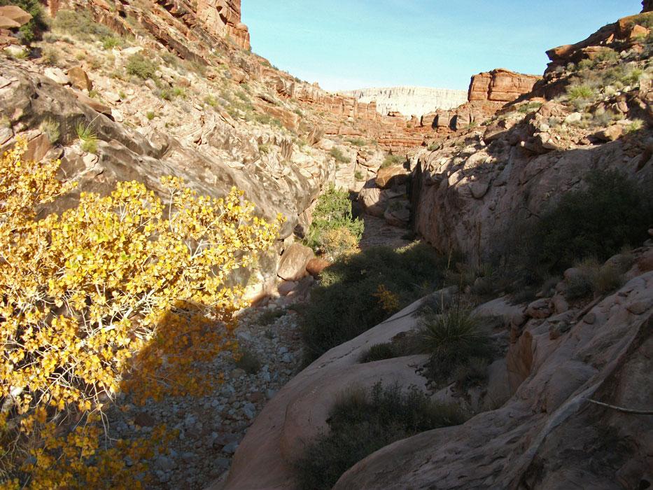
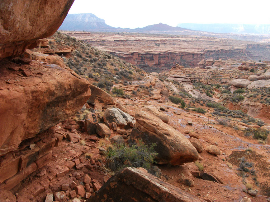
and turns north at the top of the Coconino sandstone. After a quarter mile, the trail turns west and drops steeply through a break in the Coconino. At this point the expanse of the Esplanade opens up before you and the
views
are stunning. The trail reaches the Esplanade at a small clump of Cottonwoods, which are in the upper reaches of Kwagunt Hollow. Soon I was looking down into
Ojojojo Canyon
and to Racetrack Knoll in the distance.
At the clump of Cottonwoods, I turned south off the Sowats Point trail and soon found a great trail that I hadn't known about (and isn't on any maps). I wanted to head down to Indian Hollow via an unnamed canyon, which I later learned was referred to by George Steck as Ojojojo (Steck describes how he came up with this name in his book Grand Canyon Loop Hikes II. ) I knew the canyon would go because I had once seen a group of day-hikers come down the canyon. It turned out to be pretty easy, but a little brushy in the
upper end.
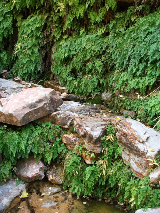
About 2/3 of the way down Ojojojo I encountered a
beautiful spring
with a relatively large flow and replete with Maidenhair ferns. The water flowed down the canyon and over a fall near Indian Hollow, and then disappeared into the gravel.
A few minutes past the falls I reached Indian Hollow. This was my fourth time visiting Indian Hollow. It is a friendly canyon mostly in the Supai formation, and it usually has a small flow of water. It is one of my favorites. I hiked up-canyon for an hour or so, where I stopped to
camp
by some clear potholes. Because it hadn't rained in the area for two months, and because hiking solo has a way of focusing your attention on potential problems, I got a little squeamish and decided to abandon plans to circumambulate Fishtail Mesa. Instead I decided to climb Racetrack Knoll, and check out the Esplanade on the way.
November 10, 2009. After a leisurely breakfast, I packed a lunch and 3 quarts of water, then hiked up Indian Hollow for a short
ways before turning into a
side canyon
on stream left. It starts at about the 3880-ft elevation level. The hike up this canyon was mostly easy, except for the last 20 feet of Esplanade standstone. I finally found a safe way up, but it did require some climbing. I expect I could have found an easier way up if I had looked around a little more.
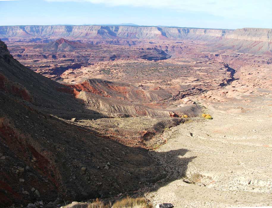
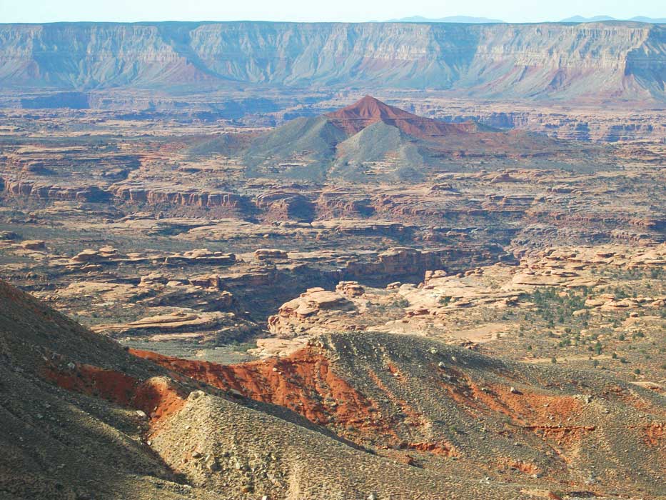
Once on the Esplanade, I headed straight for Racetrack Knoll. It was still hidden behind a small rise, but soon I had a clear view. It was still about a mile away, but the route to it was almost completely flat. From the base of the Knoll I hiked straight up for a hundred feet or so, then climbed to the right to gain a ridge that went all the way to the top and looked easier than a direct approach.
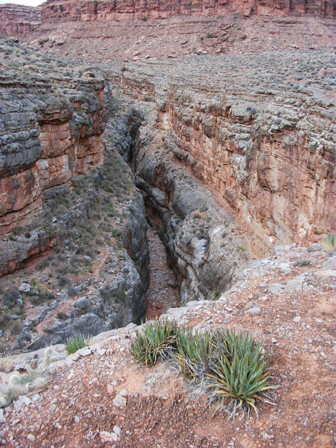
Racetrack Knoll provided spectacular
360-degree views.
There is a register on the summit with several names that I recognized, including Traci Wyrick and Ken Walters from a trip they did in September. The most recent entry before that was from 2005. After snapping some photos I retraced my route back to my camp in Indian Hollow. I spent a second night in Indian Hollow.
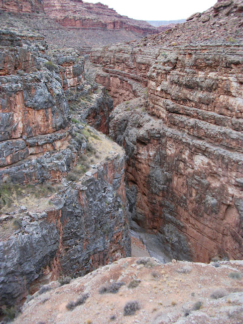
November 11, 2009. Today I decided to head for Kwagunt Hollow. I had never hiked through Kwagunt Hollow before and was excited to do so. To avoid a chockstone with a pouroff and a large pool below (Steck's Obstacle Pool), I hiked down Indian Hollow until I reached the top of the Redwall limestone. I then continued hiking on
top of the Redwall,
contouring all the way around to Kwagunt, where the canyon floor had risen to the level of the top of the Redwall. The hiking along the Redwall rim was relatively easy, certainly easier than hiking down Indian Hollow. The views down into Indian Hollow and Jumpup were awesome. Here is where I ran into the only people I saw on this trip. They were a couple doing a very long day hike from Sowats trailhead. I heard them below me at the
Jumpup/Indian Hollow confluence.
I yelled down to them, and it took them a while to figure out where I was. Later they passed through my camp in Kwagunt on their return.
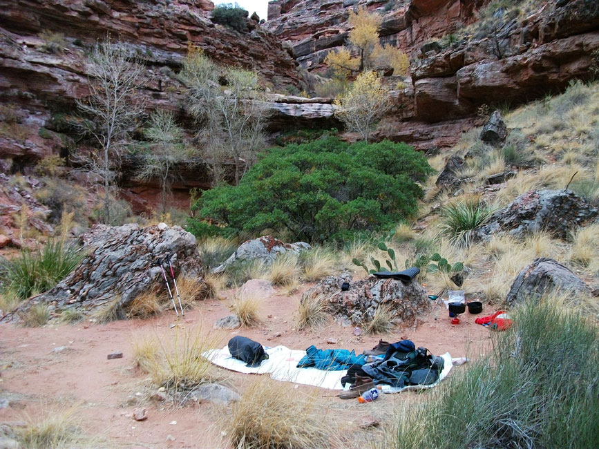
As I turned up Jumpup heading for Kwagunt, the canyon bottom slowly rose to meet me at Kwagunt. I turned into Kwagunt and soon found a small flow of water. In less than an hour I came to a 50-ft pouroff with a trickling waterfall. There was an easy bypass on the right. As soon as I reached the top of the first pouroff, I encountered a second one only a couple of hundred yards up-canyon. I camped at a
nice spot
between the two waterfalls. Although the flow of water was only a trickle, I suspect it is reliable because of the buildup of
travertine
seen on the waterfalls. About an hour before dark, the two people I
had seen earlier came through my camp. Although they were moving fast, there is no way they would make it back to the trailhead before dark. I figured they had at least two more hours of fast hiking.
November 12, 2009. I had never been to Kwagunt Hollow before, so I was excited to get going. The hike was pretty straightforward, with no significant obstacles. The canyon is very pretty and lush. Because rain was threatening, I decided to hike all the way up Kwagunt to the Jumpup-Nail trail, which goes all the way to Sowats Canyon and then connects with the Ranger Trail. From there I would take the trail to Sowats Canyon, then hike down Sowats to Mountain Sheep Spring. I knew there was a nice overhang there in case it rained. So at the top of Kwagunt, I took the left (north) branch, which was a little shorter. It took a little scouting to find an easy way up. I picked up the trail and in no time I was
heading down into Sowats. The trail was in better condition than I remembered it from many years ago. As I was heading down, I noticed the Ranger Trail exiting Sowats Canyon on the opposite wall. It was composed of numerous stairs -- a lot of trail construction for such a remote trail. I was intrigued by the thought of hiking up that trail and over into Jumpup.
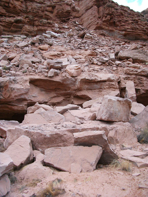
As I was hiking down Sowats, I came to a
large rock-fall
that littered the canyon bottom. A large section of the canyon wall had fallen and rolled down into the canyon. It must have been a recent event since there was still thick dust all over the rocks, and
huge gouges
in the sandy creek bottom where the boulders hit and then rolled
a bit further.
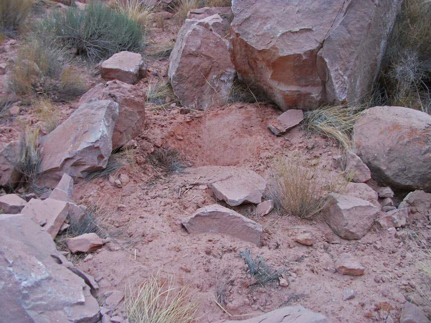
I set up camp on the slickrock rather than under the overhang. I usually prefer to be out in the open with a view of the stars. However, around 5:00 it started to rain, and I quickly moved to the overhang.
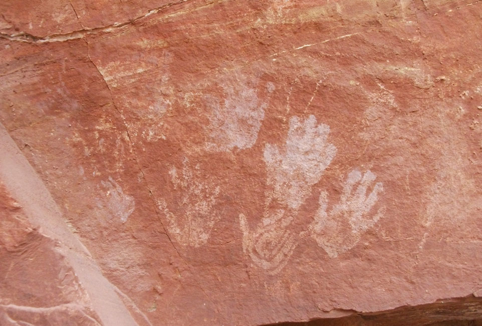
November 13, 2009. This morning I was delighted to see the
rock art
decorating the overhang. I didn't know they were there and completely missed them the last time I was here. The rain stopped soon after sunrise. I packed up my daypack and headed back up-canyon to the trail. I turned north, climbed up the stairs to the Esplanade, and followed the trail around and into Jumpup Canyon. It rained on and off for the first few hours, interspersed with sunshine. I stopped a couple of times at
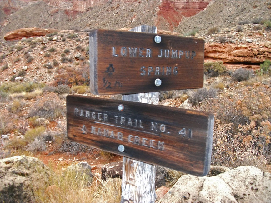
opportune overhangs to wait out a few of the downpours. The colors were intense, and the pungent, herbal odors were wonderful. The trail soon reached Jumpup Canyon and the first
sign
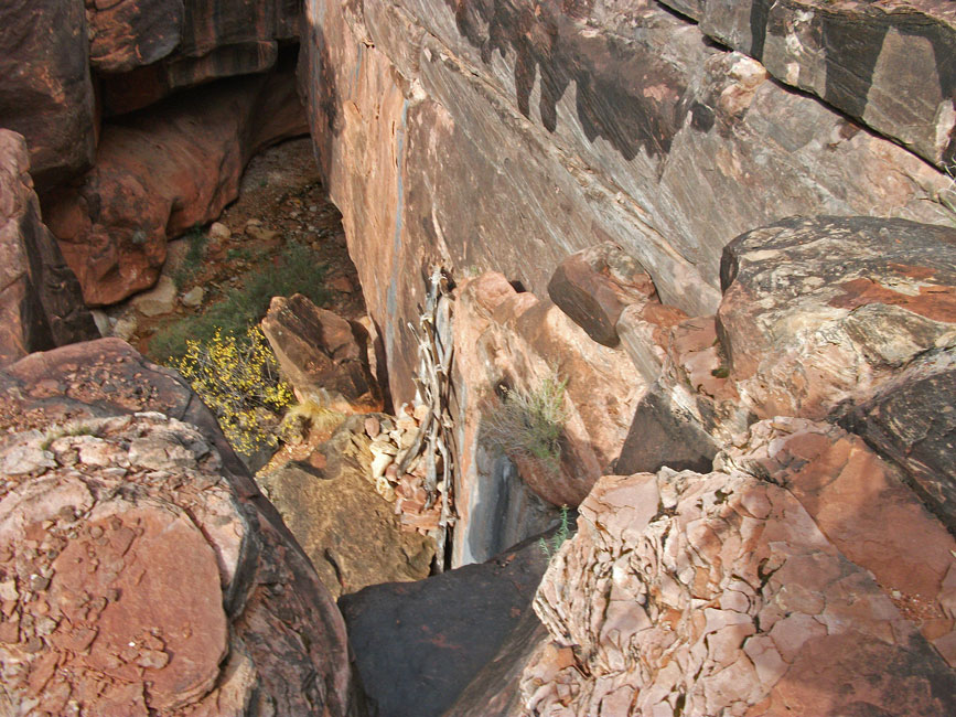
I had seen since leaving the Jumpup-Nail trailhead. I reached lower Jumpup Spring in another 20 minutes, and soon discovered the "jump". I knew there was a
rickety, hand-made ladder
to help get down, but it took me a while to find it. I was almost ready to turn around and head back the way I came when I finally saw it. The climb down the ladder didn't look hard, but it was definitely exposed. I was a little
unnerving climbing down to the ladder on wet rock while I was alone. Of course, there was the ubiquitous bolt placed at the top of the climb. From there it was a short hike down Jumpup to Sowats, and up Sowats to my camp at the spring. It rained on and off all night.
Update: The ladder was removed in 2020 and has been
replaced by a rope handline with loops. It is now much more difficult.
November 14, 2009. It was cold and dreary in the morning. I packed up early and headed for my car. But before climbing out of Sowats Canyon, I continued up the canyon looking for Bitter Spring. I could not find any sign of it. The
potholes along the Esplanade were now overflowing. If I had started this hike now instead of 6 days ago, I might have been able to hike around Fishtail Mesa.
Overall it was a wonderful, leisurely hike. I enjoy hiking alone, but would rather be with a group at camp. I can't wait to go back and explore more. I have a March permit for a hike with my daughter (spring break), and some friends want to get back here in April, so maybe I'll do two back-to-back trips in the spring.
|