|
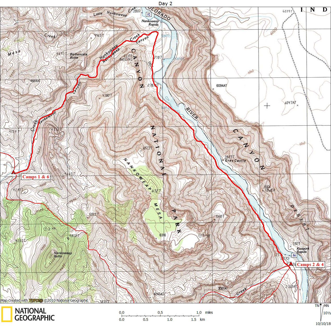
Day 2 October 11, 2010 Bottom of Nankoweap Trail to Kwagunt Creek at the River |
 |
|
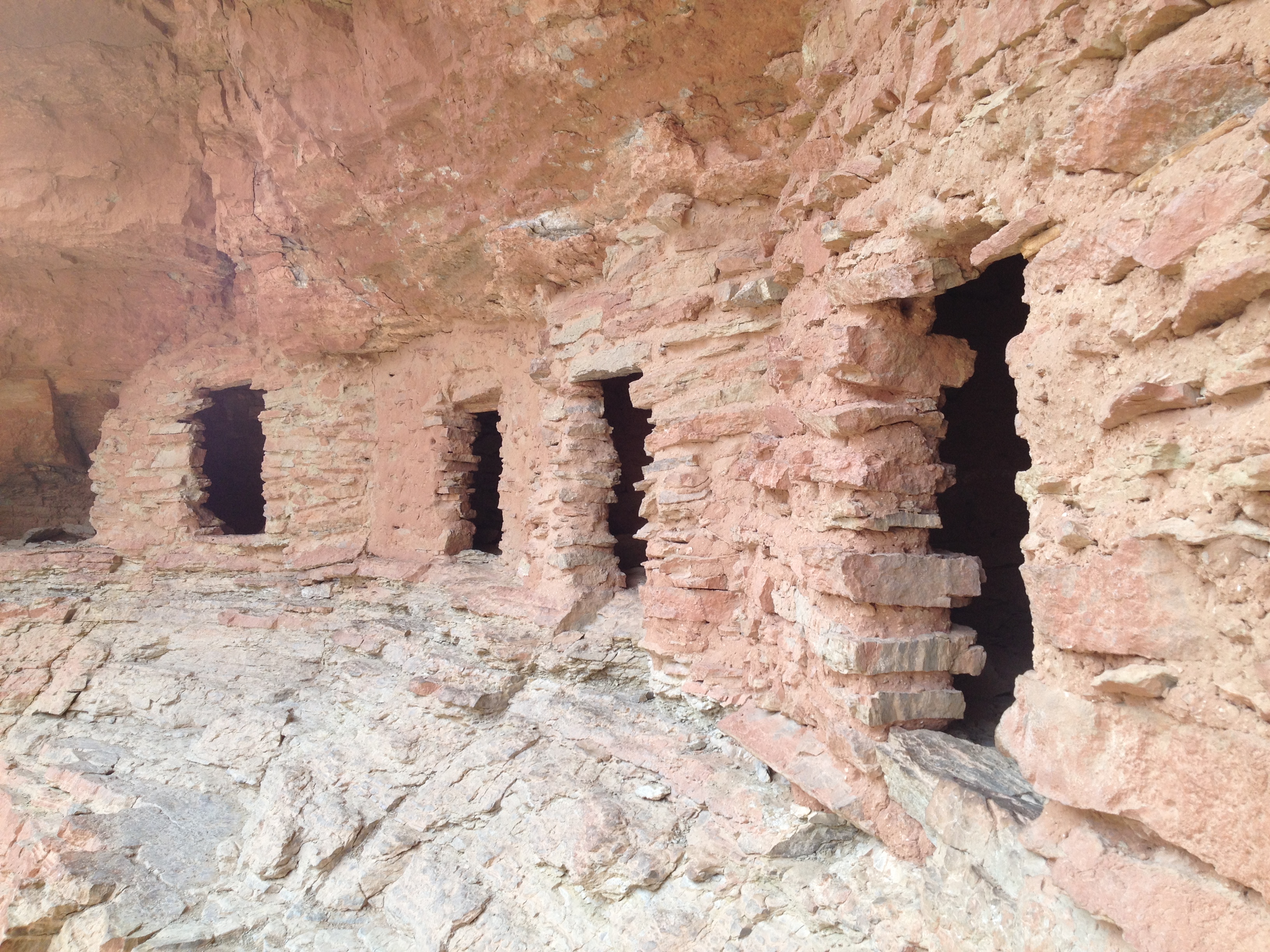
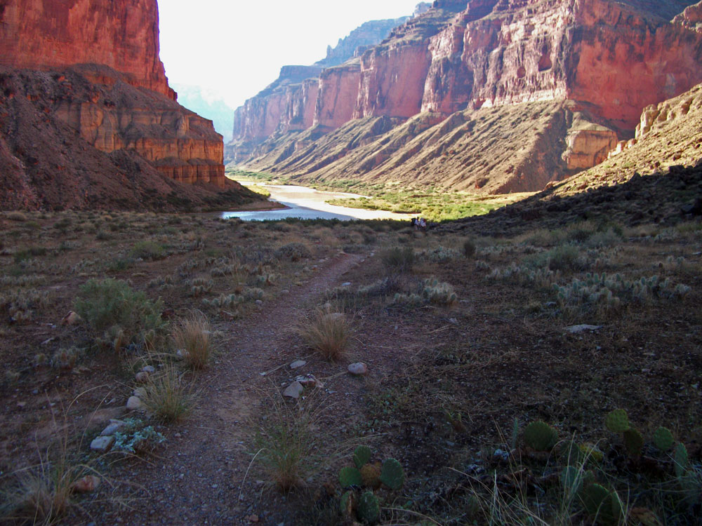
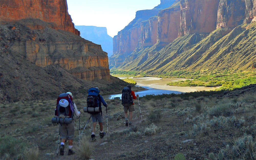
Click on photos to see larger image. Today's route stats: Distance: 6 miles Elevation Gain: 0 feet Elevation Loss: 700 feetToday was expected to be pretty easy. A few people got up early and did a short hike. After a leisurely breakfast, we packed up and headed down-stream. We stopped at the mouth of Nankoweap for a while, then continued down the River to the mouth of Kwagunt, our destination for the day.
|