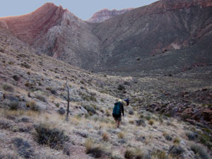
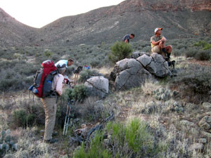
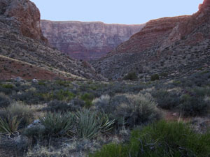
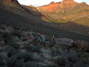
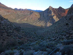
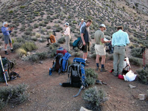
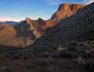
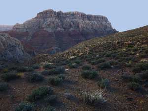
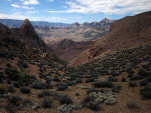
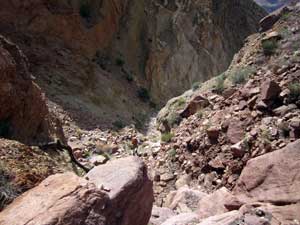
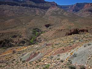
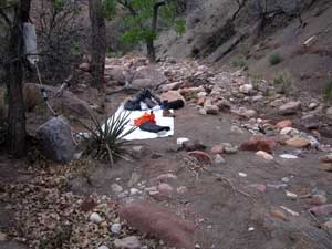
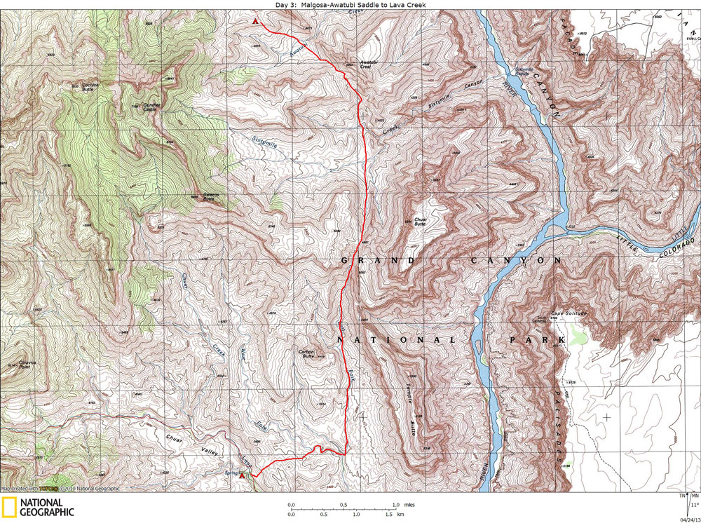
Day 3

April 5, 2013

Malgosa-Awatubi Saddle to Lava Creek


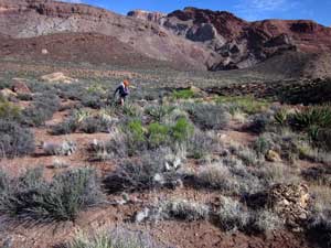
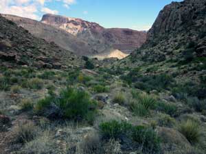
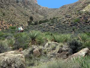
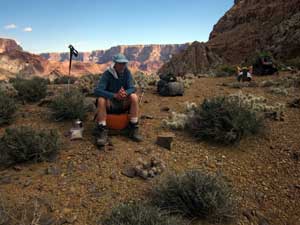
Click on photos to see larger image.

Today's route stats: 

    Distance:  Difficult to determine off-trail miles, but probably about 7.

    Elevation Gain:  1700 feet

    Elevation Loss:  3400 feet

Today was expected to be long and tiring.   We got another very early start.   Bert called out "Hot Water" around 4:45 am.  A flashlight was needed until around 5:45, when we began to hiking down into Awatubi.  I started out carrying 3 quarts of water, hoping that it would be enough.  We wouldn't find water until our camp in Lava at the end of the day.

Dropping Down Into Awatubi. Taking a Break in Awatubi. View Down Into Awatubi Canyon.

We dropped the 700 feet to the bottom of Awatubi in about 45 minutes.  After a short break, we continued onward and upward to the Awatubi-Sixtymile saddle.   The views were awesome, and the weather was perfect.  We reached the saddle at 7:20, after a climb of 550 feet.  I was feeling pretty good, and much relieved that my muscles had recovered from yesterday. 

Climbing To Awatubi-Sixtymile Saddle Awatubi Crest.  Awatubi-Sixtymile Saddle.

The hike up to Awatubi-Sixtymile saddle was pretty straightforward and not too difficult.  It took us about 50 minutes to climb the 550 feet to the saddle.  The views were tremendous.  And the feeling of remoteness and isolation was intense. 

Awatubi Crest and Kwagunt Butte.

Chuar Butte.

Ben in Sixtymile Creek Drainage.

The 800 foot hike down from the saddle into the Sixtymile Creek drainage presented no difficulties, and we reached the bottom in about 90 minutes.  The Sixtymile Creek drainage is pretty broad at the point where we crossed just west of the Butte Fault.  And perhaps I should have mentioned this before, but all of these drainages (or creeks), except Kwagunt, were bone dry.  The gnats, however, were ever-present and extremely obnoxious.  I am pretty sure that the two dark spots in the upper left photo are gnats. 

Looking N Toward Kwagunt Butte. Hiking UP to Sixtymile-Carbon Saddle Ben on Sixtymile-Carbon Saddle.

We now had our last major climb of the day -- the 800 feet climb to the Sixtymile-Carbon saddle.  The hiking was relatively easy and we reached the saddle in about 70 minutes. 

Although we had been hiking for a little more than 4 hours, it was still only 10 am., and we still had over 3 miles of rugged off-trail hiking to get to Still Spring in Lava Creek.  To get to Lava Creek, we first needed to descend into Carbon Creek, then hop over a low ridge and down into Lava. 

It is a long hike down the East Fork of Carbon, and the first part was rough and steep.  The terrain began to level out some after dropping about 1000 feet.  But we still needed to drop another 600 feet before turning off and heading up the West Fork of Carbon.  The views down the canyon were amazing.  The terrain ahead was starting to look familiar as I had done a solo hike into Lava and Carbon two years earlier. 

East Fork of Carbon from Saddle. East Fork of Carbon Dropping Down to Still Spring in Lava.
It was starting to get pretty hot when we reached the West Fork of Carbon Creek around 12:45 pm.  We turned and started up the West Fork, planning to turn off soon and head directly to Still Spring.  It was not obvious where to turn off -- the terrain was more convoluted than I expected from looking at contour lines on the map.  Our group got separated as we each took a slightly different line.  When we reached the top where we could begin to look directly down into Lava, I was a couple of hundred yards north of the others.  No problem -- we would all meet at Still Spring, our destination for the day.  On the way down there are cliff bands to deal with, usually by contouring over to a break.  I ended up hiking down through a small side canyon that reached Lava a couple of hundred yards below Still Spring.  I was a little surprised to see no one at the spring when I got there, around 1:45 pm.  I unloaded part of my pack, collected more water, and ate lunch.  I was tired and very glad to be done with hiking for the day.
My Home at Still Spring on Lava Creek. Coffee Grinder near Lava Spring.  
I waited for the others, expecting to see them any minute.  I started getting a little worried after 30 minutes or so.  I figured we would all get to the spring about the same time, so how could they be taking so long?  I began concocting scenarios of twisted ankles or worse.  Just as I was about to head down Lava to look for them, Bert called my name from up-stream.  They got to the spring first, then continued up-canyon a short ways looking for a campsite that would better accommodate all seven of us.  For some reason they were sure I was farther up-canyon.  Anyway, as George Steck once said, all's well that ends. 

I'm not sure how Still Spring got it's name (unofficial -- not on the topo map), but perhaps from the old coffee grinder that is now deeply embedded into a growing Cottonwood.  But what is an industrial-sized coffee grinder doing in such a remote place?  Even though "coffee grinder" is cast into the iron wheel of the grinder, maybe it was used for something else.  But for moonshine whisky? 


Back to Main Trip Index Back to Trip Index Back to Day 2 Forward to Day 4